Citation:
Citation_Information:
Originator: Adam M. Davis
Originator: C. Scott Southworth
Originator: J. Stephen Schindler
Originator: James E. Reddy
Publication_Date: 2001
Title:
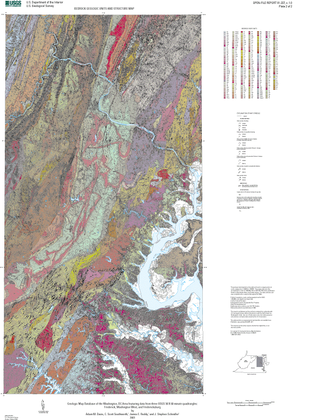
Geologic Map Database of the Washington DC Area Featuring Data From Three 30 X 60 Minute Quadrangles: Frederick, Washington West, and Fredericksburg
Edition: 1.0
Geospatial_Data_Presentation_Form: Tabular digital data and map
Series_Information:
Series_Name: U.S. Geological Survey Open-File Report
Issue_Identification: 01-227
Publication_Information:
Publication_Place: Reston, Virginia
Publisher: U.S. Geological Survey
Online_Linkage: http://pubs.usgs.gov/of/2001/of01-227/
Description:
Abstract:
The Washington DC Area geologic map database (DCDB) provides geologic map information of areas to the NW, W, and SW of Washington, DC to various professionals and private citizens who have uses for geologic data. Digital, geographically referenced, geologic data is more versatile than traditional hard copy maps, and facilitates the examination of relationships between numerous aspects of the geology and other types of data such as: land-use data, vegetation characteristics, surface water flow and chemistry, and various types of remotely sensed images. The DCDB was created by combining Arc/Info coverages, designing a Microsoft (MS) Access database, and populating this database. Proposed improvements to the DCDB include the addition of more geochemical, structural, and hydrologic data.
Purpose:
Geology was researched and compiled for use in studies of ecosystem health, environmental impact, soils, groundwater, land use, tectonics, crustal genesis, sedimentary provenance, and any others that could benefit from geographically referenced geological data.
Supplemental_Information:
Data are provided in several common GIS formats and MS Access database files. The geologic data themes included are bedrock, surficial, faults and fold axes, neat line, structural data, and sinkholes; the base themes are political boundaries, roads, elevation contours, and hydrography.
Data were originally collected in UTM coordinates, zone 18, NAD 1927, and projected to geographic coordinates (Lat/Long), NAD 1983. The data base is accompanied by large format color maps, a readme.txt file, and a explanatory PDF pamphlet.
Data_Set_Structure:
Data_Set_Part:
Part_Type: Arc/Info coverages, INFO tables, and their export-interchange file equivalents (files with *.e00 extensions)
Part_Name: Geologic map data
Part_Description: These coverages and INFO tables provide the scientific content of the mapped data
Data_Set_Part:
Part_Type: Arc/Info coverage
Part_Name: BEDROCK
Part_Description: Polygon coverage for the contacts of bedrock geologic map units
Data_Set_Part:
Part_Type: Arc/Info coverage
Part_Name: FAULT
Part_Description: Line coverage for the geologic faults and folds
Data_Set_Part:
Part_Type: Arc/Info coverage
Part_Name: NEAT
Part_Description: Line coverage of the map neatline
Data_Set_Part:
Part_Type: Arc/Info coverage
Part_Name: SINK
Part_Description: Point coverage of sinkhole locations
Data_Set_Part:
Part_Type: Arc/Info coverage
Part_Name: STRUCTURE
Part_Description: Point coverage of geologic structure
Data_Set_Part:
Part_Type: Arc/Info coverage
Part_Name: SURFICIAL
Part_Description: Polygon coverage for the contacts of surficial geologic map units
Data_Set_Part:
Part_Type: Arc/Info coverages and their export-interchange file equivalents (files with *.e00 extensions)
Part_Name: Base map data
Part_Description: These coverages provide the base map to which the geologic information is geographically registered
Data_Set_Part:
Part_Type: Arc/Info coverage
Part_Name: POLBND
Part_Description: Polygon coverage of state and county boundaries
Data_Set_Part:
Part_Type: Arc/Info coverage
Part_Name: ROADS
Part_Description: Line coverage of major highways
Data_Set_Part:
Part_Type: Arc/Info coverage
Part_Name: TOPO
Part_Description: Line coverage of elevation contours
Data_Set_Part:
Part_Type: Arc/Info coverage
Part_Name: HYDRO
Part_Description: Polygon coverage of major water bodies
Data_Set_Part:
Part_Type: ArcView shapefiles (*.dbf, *.shp, *.shx) and related DBF tables
Part_Name: Geologic map data
Part_Description: These shapefiles and DBF tables provide the scientific content of the mapped data
Data_Set_Part:
Part_Type: ArcView shapefile
Part_Name: BEDROCK.*
Part_Description: Shapefiles for the contacts of bedrock geologic map units
Data_Set_Part:
Part_Type: ArcView shapefile
Part_Name: FAULT.*
Part_Description: Shapefiles for the geologic faults and folds
Data_Set_Part:
Part_Type: ArcView shapefile
Part_Name: NEAT.*
Part_Description: Shapefiles for the map neatline
Data_Set_Part:
Part_Type: ArcView shapefile
Part_Name: SINK.*
Part_Description: Shapefiles for sinkhole locations
Data_Set_Part:
Part_Type: ArcView shapefile
Part_Name: STRUCTURE.*
Part_Description: Shapefiles for geologic structure
Data_Set_Part:
Part_Type: ArcView shapefile
Part_Name: SURFICIAL.*
Part_Description: Shapefiles for the contacts of surficial geologic map units
Data_Set_Part:
Part_Type: ArcView shapefile (*.dbf, *.shp, *.shx)
Part_Name: Base map data
Part_Description: These shapefiles provide the base map to which the geologic information is geographically registered
Data_Set_Part:
Part_Type: ArcView shapefile
Part_Name: POLBND.*
Part_Description: Shapefiles for state and county boundaries
Data_Set_Part:
Part_Type: ArcView shapefile
Part_Name: ROADS.*
Part_Description: Shapefiles for major highways
Data_Set_Part:
Part_Type: ArcView shapefile
Part_Name: TOPO.*
Part_Description: Shapefiles for elevation contours
Data_Set_Part:
Part_Type: ArcView shapefile
Part_Name: HYDRO.*
Part_Description: Shapefiles for major water bodies
Data_Set_Part:
Part_Type: Spatial Data Transfer Standard (SDTS) data exchange files
Part_Name: Geologic map data
Part_Description: These SDTS files provide the scientific content of the mapped data
Data_Set_Part:
Part_Type: SDTS files
Part_Name: BEDR*.*
Part_Description: SDTS files for the contacts of bedrock geologic map units
Data_Set_Part:
Part_Type: SDTS files
Part_Name: FAUL*.*
Part_Description: SDTS files for the geologic faults and folds
Data_Set_Part:
Part_Type: SDTS files
Part_Name: NEAT*.*
Part_Description: SDTS files for the map neatline
Data_Set_Part:
Part_Type: SDTS files
Part_Name: SINK*.*
Part_Description: SDTS files for sinkhole locations
Data_Set_Part:
Part_Type: SDTS files
Part_Name: STRU*.*
Part_Description: SDTS files for the geologic structure
Data_Set_Part:
Part_Type: SDTS files
Part_Name: SURF*.*
Part_Description: SDTS files for the contacts of surficial geologic map units
Data_Set_Part:
Part_Type: Spatial Data Transfer Standard (SDTS) data exchange files
Part_Name: Base map data
Part_Description: These SDTS files provide the base map to which the geologic information is geographically registered
Data_Set_Part:
Part_Type: SDTS files
Part_Name: POLB*.*
Part_Description: SDTS files for state and county boundaries
Data_Set_Part:
Part_Type: SDTS files
Part_Name: ROAD*.*
Part_Description: SDTS files for major highways
Data_Set_Part:
Part_Type: SDTS files
Part_Name: TOPO*.*
Part_Description: SDTS files for elevation contours
Data_Set_Part:
Part_Type: SDTS files
Part_Name: HYDR*.*
Part_Description: SDTS files for major water bodies
Data_Set_Part:
Part_Type: Microsoft Access databases and their ASCII text file equivalents (files in the 'text_tables' folder with *.txt extensions)
Part_Name: Geologic database
Part_Description: These databases contain attribute information that can be used as supplements to the GIS layers
Data_Set_Part:
Part_Type: Microsoft Access database
Part_Name: DCDB_EESP.MDB
Part_Description: Database designed by the Eastern Region's Earth Surface Processes Team (EESPT) of the U.S. Geological Survey
Data_Set_Part:
Part_Type: Microsoft Access database
Part_Name: DCDB_DM.MDB
Part_Description: Database resulting from the conversion of the DCDB_EESP.MDB database to a format compatible with the North American Data Model Standard for Geologic Map Data Version 4.3 (NADM) of Johnson et al. (1988)
Time_Period_of_Content:
Time_Period_Information:
Range_of_Dates/Times:
Beginning_Date: 1988
Ending_Date: 2001
Currentness_Reference: Publication date
Status:
Progress: Complete
Maintenance_and_Update_Frequency: None planned
Spatial_Domain:
Bounding_Coordinates:
West_Bounding_Coordinate: -78.00
East_Bounding_Coordinate: -77.00
North_Bounding_Coordinate: 39.50
South_Bounding_Coordinate: 38.00
Keywords:
Theme:
Theme_Keyword_Thesaurus: USGS Thesaurus
Theme_Keyword: geology
Theme_Keyword: geologic maps
Theme_Keyword: bedrock geologic units
Theme_Keyword: surficial geologic units
Theme_Keyword: faulting (geologic)
Theme_Keyword: geologic structure
Theme_Keyword: geospatial datasets
Theme:
Theme_Keyword_Thesaurus: ISO 19115 Topic Categories
Theme_Keyword: geoscientificInformation
Place:
Place_Keyword_Thesaurus: none
Place_Keyword: Frederick
Place_Keyword: Maryland
Place_Keyword: Washington
Place_Keyword: DC
Place_Keyword: Fredericksburg
Place_Keyword: Virginia
Place_Keyword: West Virginia
Place:
Place_Keyword_Thesaurus: Augmented FIPS 10-4 and FIPS 6-4
Place_Keyword: US11 = District of Columbia
Place_Keyword: f24013 = Carroll
Place_Keyword: f24021 = Frederick
Place_Keyword: f24027 = Howard
Place_Keyword: f24031 = Montgomery
Place_Keyword: f24043 = Washington
Place_Keyword: f51043 = Clarke
Place_Keyword: f51059 = Fairfax
Place_Keyword: f51061 = Fauquier
Place_Keyword: f51107 = Loudoun
Place_Keyword: f54003 = Berkeley
Place_Keyword: f54037 = Jefferson
Place_Keyword: f24017 = Charles
Place_Keyword: f24033 = Prince George's
Place_Keyword: f51013 = Arlington
Place_Keyword: f51047 = Culpeper
Place_Keyword: f51153 = Prince William
Place_Keyword: f51157 = Rappahannock
Place_Keyword: f51179 = Stafford
Place_Keyword: f51033 = Caroline
Place_Keyword: f51057 = Essex
Place_Keyword: f51085 = Hanover
Place_Keyword: f51099 = King George
Place_Keyword: f51109 = Louisa
Place_Keyword: f51137 = Orange
Place_Keyword: f51177 = Spotsylvania
Place_Keyword: f51193 = Westmoreland
Access_Constraints: None
Use_Constraints:
Although all data released in this report have been used by the USGS, no warranty, expressed or implied, is made by the USGS as to the accuracy of the data and related materials and (or) the functioning of the software. Any use of trade, product, or firm names is for descriptive purposes only and does not imply endorsement by the U.S. Government.
Point_of_Contact:
Contact_Information:
Contact_Person_Primary:
Contact_Person: C. Scott Southworth
Contact_Organization: U.S. Geological Survey
Contact_Address:
Address_Type: Mailing address
Address: National Center, MS926A
City: Reston
State_or_Province: Virginia
Postal_Code: 20192
Country: USA
Contact_Voice_Telephone: 703-648-6385
Contact_Facsimile_Telephone: 703-648-6953
Contact_Electronic_Mail_Address: [email protected]
Browse_Graphic:
Browse_Graphic: