Citation:
Citation_Information:
Originator: Christopher J. Potter
Originator: Donald S. Sweetkind
Originator: Robert P. Dickerson
Originator: Michele L. Killgore
Publication_Date: 2002
Title:
Hydrostructural Maps of the Death Valley Regional Flow System, Nevada and California--Map A: Structural Framework, Neogene Basins, and Potentiometric Surface; Map B: Structural Framework, Earthquake Epicenters, and Potential Zones of Enhanced Hydraulic Conductivity
Edition: 1.0
Geospatial_Data_Presentation_Form: map
Series_Information:
Series_Name: U.S. Geological Survey Miscellaneous Field Studies
Issue_Identification: MF-2372
Publication_Information:
Publication_Place: Denver, Colorado
Publisher: U.S. Geological Survey
Online_Linkage: http://pubs.usgs.gov/mf/2002/mf-2372/
Description:
Abstract:
The locations of principal faults and structural zones that may influence ground-water flow were compiled in support of a three-dimensional ground-water model for the Death Valley regional flow system (DVRFS), which covers 80,000 square km in southwestern Nevada and southeastern California. Faults include Neogene extensional and strike-slip faults and pre-Tertiary thrust faults. Emphasis was given to characteristics of faults and deformed zones that may have a high potential for influencing hydraulic conductivity. These include: (1) faulting that results in the juxtaposition of stratigraphic units with contrasting hydrologic properties, which may cause ground-water discharge and other perturbations in the flow system; (2) special physical characteristics of the fault zones, such as brecciation and fracturing, that may cause specific parts of the zone to act either as conduits or as barriers to fluid flow; (3) the presence of a variety of lithologies whose physical and deformational characteristics may serve to impede or enhance flow in fault zones; (4) orientation of a fault with respect to the present-day stress field, possibly influencing hydraulic conductivity along the fault zone; and (5) faults that have been active in late Pleistocene or Holocene time and areas of contemporary seismicity, which may be associated with enhanced permeabilities.
The faults shown on maps A and B are largely from Workman and others (in press), and fit one or more of the following criteria: (1) faults that are more than 10 km in map length; (2) faults with more than 500 m of displacement; and (3) faults in sets that define a significant structural fabric that characterizes a particular domain of the DVRFS. The following fault types are shown: Neogene normal, Neogene strike-slip, Neogene low-angle normal, pre-Tertiary thrust, and structural boundaries of Miocene calderas. We have highlighted faults that have late Pleistocene to Holocene displacement (Piety, 1996). Areas of thick Neogene basin-fill deposits (thicknesses 1-2 km, 2-3 km, and >3 km) are shown on map A, based on gravity anomalies and depth-to-basement modeling by Blakely and others (1999). We have interpreted the positions of faults in the subsurface, generally following the interpretations of Blakely and others (1999). Where geophysical constraints are not present, the faults beneath late Tertiary and Quaternary cover have been extended based on geologic reasoning. Nearly all of these concealed faults are shown with continuous solid lines on maps A and B, in order to provide continuous structures for incorporation into the hydrogeologic framework model (HFM). Map A also shows the potentiometric surface, regional springs (25-35 degrees Celsius, D'Agnese and others, 1997), and cold springs (Turner and others, 1996).
Purpose:
These maps (maps A and B) were prepared in support of a regional three-dimensional ground-water model currently being constructed by the U.S. Geological Survey (USGS) for the DVRFS. The maps identify regional geologic structures whose possible hydrologic significance merits their inclusion in the HFM for the DVRFS.
Supplemental_Information:
A composite base map is included based upon published 83-m DEM data from USGS 1:250,000-scale quadrangles, as well as road lines and political boundaries from published USGS 1:100,000-scale DLG data. The 1:100,000-scale data were generalized to 1:250,000 scale for inclusion with the 1:250,000-scale database.
Additional coverages include a ground-water model area coverage, and text labels for structural features. Files necessary for printing the map are also included such as text fonts, linesets, shadesets, projection files, and AML files. These files are all explained in the included README.txt file.
Time_Period_of_Content:
Time_Period_Information:
Single_Date/Time:
Calendar_Date: 2002
Currentness_Reference: Publication date
Status:
Progress: Complete
Maintenance_and_Update_Frequency: None planned
Spatial_Domain:
Bounding_Coordinates:
West_Bounding_Coordinate: -118.000
East_Bounding_Coordinate: -115.000
North_Bounding_Coordinate: 38.250
South_Bounding_Coordinate: 35.000
Keywords:
Theme:
Theme_Keyword_Thesaurus: USGS Thesaurus
Theme_Keyword: geologic maps
Theme_Keyword: hydrogeology
Theme_Keyword: geospatial datasets
Theme_Keyword: geologic structure
Theme_Keyword: bedrock geologic units
Theme_Keyword: groundwater flow
Theme_Keyword: faulting (geologic)
Theme_Keyword: mathematical modeling
Theme:
Theme_Keyword_Thesaurus: American Geological Institute (AGI) Glossary of Geology
Theme_Keyword: Death Valley regional flow system
Theme_Keyword: ground-water model
Theme_Keyword: Neogene extenstional faults
Theme_Keyword: Neogene strike-slip faults
Theme_Keyword: pre-Tertiary thrust faults
Theme_Keyword: fault zones
Theme_Keyword: seismicity
Theme_Keyword: hydrogeologic framework model
Theme_Keyword: hydrostratigraphy
Theme_Keyword: hydrostructural map
Theme_Keyword: hydrogeologic map
Theme_Keyword: hydraulic properties
Theme_Keyword: flow barriers
Theme_Keyword: hydrogeology
Theme_Keyword: hydrogeologic units
Theme_Keyword: Miocene calderas
Theme_Keyword: central Death Valley volcanic field
Theme_Keyword: southwest Nevada volcanic field
Theme_Keyword: nonmarine sedimentary basins
Theme_Keyword: Tertiary and Quaternary basins
Theme_Keyword: lower carbonate aquifer
Theme_Keyword: upper clastic confining unit
Theme_Keyword: lower clastic confining unit
Theme_Keyword: volcanic confining unit
Theme_Keyword: metamorphic rocks
Theme_Keyword: Miocene densely welded tuffs
Theme_Keyword: fracture-controlled permeability
Theme_Keyword: Proterozoic and Lower Cambrian clastic rocks
Theme_Keyword: Mississippian clastic rocks
Theme_Keyword: Miocene lavas
Theme_Keyword: Paleozoic carbonates
Theme_Keyword: Yucca Mountain Project
Theme_Keyword: U.S. Department of Energy
Theme_Keyword: U.S. Geological Survey
Theme_Keyword: MODFLOW
Theme_Keyword: basin-and-range
Theme_Keyword: detachment faults
Theme_Keyword: caldera boundaries
Theme_Keyword: springs
Theme_Keyword: ground-water discharge
Theme_Keyword: aquifers
Theme_Keyword: brittle faults
Theme_Keyword: ductile faults
Theme_Keyword: core zone
Theme_Keyword: damage zones
Theme_Keyword: zones with potentially large hydraulic conductivities
Theme_Keyword: metamorphic core complexes
Theme:
Theme_Keyword_Thesaurus: ISO 19115 Topic Categories
Theme_Keyword: geoscientificInformation
Place:
Place_Keyword_Thesaurus:
U.S. Board on Geographic Names (BGN) Geographic Names Information System (GNIS).
Place_Keyword: Death Valley
Place_Keyword: southwestern Nevada
Place_Keyword: southeastern California
Place_Keyword: Amargosa Desert
Place_Keyword: Oasis Valley
Place_Keyword: Tecopa
Place_Keyword: Nevada Test Site
Place_Keyword: Yucca Mountain
Place_Keyword: Greenwater Range
Place_Keyword: Ash Meadows ground-water basin
Place_Keyword: Oasis Valley
Place_Keyword: Pahrump Valley
Place_Keyword: Devils Hole
Place_Keyword: Basin and Range province
Place_Keyword: Las Vegas
Place_Keyword: Bat Mountain
Place_Keyword: Funeral Mountains
Place_Keyword: Las Vegas Valley
Place_Keyword: Bare Mountain
Place_Keyword: Amargosa Desert
Place_Keyword: Black Mountains
Place_Keyword: Furnace Creek
Place_Keyword: Stewart Valley
Place_Keyword: Mine Mountain
Place_Keyword: Spotted Range
Place_Keyword: Mercury
Place_Keyword: Specter Range
Place_Keyword: Rock Valley
Place_Keyword: Spring Mountains
Place_Keyword: Montgomery Mountains
Place_Keyword: Resting Spring
Place_Keyword: Nopah Range
Place_Keyword: Spring Mountains
Place_Keyword: Thirsty Mountain
Place_Keyword: Silent Mountain
Place_Keyword: Timber Mountain
Place_Keyword: Greenwater Range
Place_Keyword: Black Mountains
Place_Keyword: Beatty, Nevada
Place_Keyword: Fortymile Canyon
Place_Keyword: Furnace Creek Ranch
Place_Keyword: Schwaub Peak
Place_Keyword: Willow Spring
Place_Keyword: Cold Creek Spring
Place_Keyword: Indian Springs
Place_Keyword: Wheeler Pass
Place_Keyword: Resting Springs Range
Place_Keyword: Big Dune
Place_Keyword: Point of Rocks
Place_Keyword: Devils Hole
Place_Keyword: Owens Valley
Place_Keyword: Slate Ridge
Place_Keyword: Last Chance Range
Place_Keyword: Gold Mountain
Place_Keyword: Mercury Valley
Place_Keyword: Pintwater Range
Place:
Place_Keyword_Thesaurus: Augmented FIPS 10-4 and FIPS 6-4
Place_Keyword: f06027 = Inyo
Place_Keyword: f06071 = San Bernardino
Place_Keyword: f06029 = Kern
Place_Keyword: f32023 = Nye
Place_Keyword: f32017 = Lincoln
Place_Keyword: f32009 = Esmeralda
Place_Keyword: f32003 = Clark
Access_Constraints: None
Use_Constraints:
None. Acknowledgment of the U.S. Geological Survey would be appreciated in products derived from these data.
Point_of_Contact:
Contact_Information:
Contact_Person_Primary:
Contact_Person: Christopher J. Potter
Contact_Organization: U.S. Geological Survey
Contact_Address:
Address_Type: mailing address
Address: Denver Federal Center, MS-939
Address: Box 25046
City: Denver
State_or_Province: Colorado
Postal_Code: 80225
Country: USA
Contact_Voice_Telephone: 303-236-1735
Contact_Electronic_Mail_Address: cpotter@usgs.gov
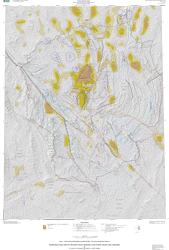
Browse_Graphic:
Browse_Graphic:
Data_Set_Credit:
Neogene and pre-Tertiary faults modified from Workman and others, 2002, by C.J. Potter. Late Pleistocene and Holocene faults from Piety, 1996. Modified faults digitized by M. L. Killgore.
Native_Data_Set_Environment: Sun OS 5.7, sun4m, ARC/INFO version 9.0.2