Online Links:
COLUMN--ITEM_NAME----------WIDTH-----OUTPUT-----TYPE---#_DECIMALS
1-------FNODE#---------------4----------5---------B---------\
5-------TNODE#---------------4----------5---------B---------\
9-------LPOLY#---------------4----------5---------B---------\
13------RPOLY#---------------4----------5---------B---------\
17------LENGTH---------------8---------18---------F---------5
25------<cover>#-------------4----------5---------B---------\
29------<cover>-ID-----------4----------5---------B---------\
For polygons these attributes are:
COLUMN--ITEM_NAME----------WIDTH-----OUTPUT-----TYPE---#_DECIMALS
1-------AREA-----------------8---------18---------F---------5
9-------PERIMETER------------8---------18---------F---------5
17------<cover>#-------------4----------5---------B---------\
21------<cover>-ID-----------4----------5---------B---------\
****The following coverages were used in both Map A and Map B****
COVERAGE--------ENTITIES---------DESCRIPTION
dvrfspoly-------lines/polygons---base map
halo_bd---------lines------------flow model boundary
hstruc2---------lines------------faults; attributed with ITEM h_code as follows:
ITEM: h_code           DESCRIPTION              SYMBOL
      1                Normal fault             1 (color.lin)
      2                Strike-slip fault        2 (color.lin)
      3                Detachment fault         83 (geoscamp1.lin)
      4                Caldera Boundary         83 (geoscamp1.lin)
      5                Transverse fault         5 (color.lin)
      6                Thrust fault             27 (geology.lin)
      7                Thrust fault (inferred)  37 (geology.lin)
hydrostruc_bb---lines------------displacement symbols on faults
dvrfs_rd--------lines------------roads (minor and major)
dvrfs_hptxt-----points-----------text labels for physiographic features,
                                   including town names.
county_100k-----lines------------county boundaries
nts_outline-----lines------------boundary of Nevada Test Site
nvca------------lines------------State line boundary between California
                                   and Nevada.
stipplebuffer---polygons---------stippled area on faults that have
                                   measurable late Pleistocene or younger
                                   displacement.
townpts---------points-----------locations of towns
pot_cont--------lines------------potentiometric contours with elevations
                                   posted on each contour line.
cald_txt--------points-----------text lables for calderas
flt_txt---------points-----------text lables for faults
****The following coverages are used on Map A only****
hueb, satb, valb-----------------color shaded-relief map, composited from
                                   83-m DEM data from the following USGS
                                   1:250,000-scale quadrangles:  Tonapah,
                                   Lund, Las Vegas, Death Valley,
                                   Caliente, Goldfield, Kingman, and Trona
                                   and include depth to pre-Tertiary
                                   surface.
coldsprgs-------points-----------locations of cold springs
springreg-------points-----------locations of regional springs (24 degrees
                                   C to 35 degrees C).
****The following coverages are used on Map B only****
red, green, blue-----------------color shaded-relief map, composited from
                                   83-m DEM data from the following USGS
                                   1:250,000-scale quadrangles: Tonapah,
                                   Lund, Las Vegas, Death Valley,
                                   Caliente, Goldfield, Kingman, and
                                   Trona.
polybuffer------polygons---------zones that have special geologic
                                   characteristics, as well as seismicity
                                   clusters, that may be consistent with
                                   relatively large hydraulic
                                   conductivities.
polynums--------points-----------roman numeral values used to label the
                                   "polybuffer" cover.
eq78to86--------points-----------earthquake epicenter locations.  Four (4)
                                   ITEMS from this cover were used:
                                   magnitude, date, x-coord and y-coord.
                                   The date values that fell in the range
                                   of 1978 to 1986 were used for this map.
Neogene and pre-Tertiary faults modified from Workman and others, 2002, by C.J. Potter. Late Pleistocene and Holocene faults from Piety, 1996. Modified faults digitized by M. L. Killgore.
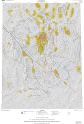
These maps (maps A and B) were prepared in support of a regional three-dimensional ground-water model currently being constructed by the U.S. Geological Survey (USGS) for the DVRFS. The maps identify regional geologic structures whose possible hydrologic significance merits their inclusion in the HFM for the DVRFS.
Are there legal restrictions on access or use of the data?Access_Constraints: None
Use_Constraints:None. Acknowledgment of the U.S. Geological Survey would be appreciated in products derived from these data.
Although these digital spatial data have been subjected to rigorous review and are substantially complete, they are released on the condition that neither the USGS nor the United States Government may be held liable for any damages resulting from their authorized or unauthorized use.
| Data format: | Flow model data and structural geologic features in format ARCE (version 8.0.2) Size: 78 |
|---|---|
| Network links: |
http://pubs.usgs.gov/mf/2002/mf-2372/mf-2372.zip http://pubs.usgs.gov/mf/2002/mf-2372/mf-2372.tar.gz |
| Data format: | Flow model data and structural geologic features in format Shapefile (version 1.0) Size: 78 |
|---|---|
| Network links: |
http://pubs.usgs.gov/mf/2002/mf-2372/mf-2372.zip http://pubs.usgs.gov/mf/2002/mf-2372/mf-2372.tar.gz |