Online Links:
| Value | Definition |
|---|---|
| 252 | Missing data |
| 255 | Land area |
| Range of values | |
|---|---|
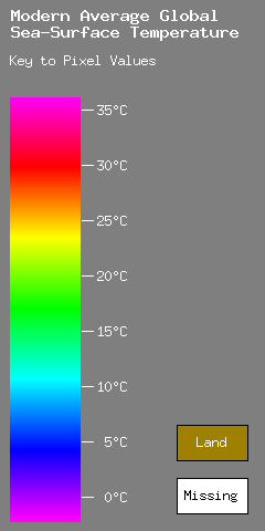
| Minimum: | 0 |
| Maximum: | 250 |
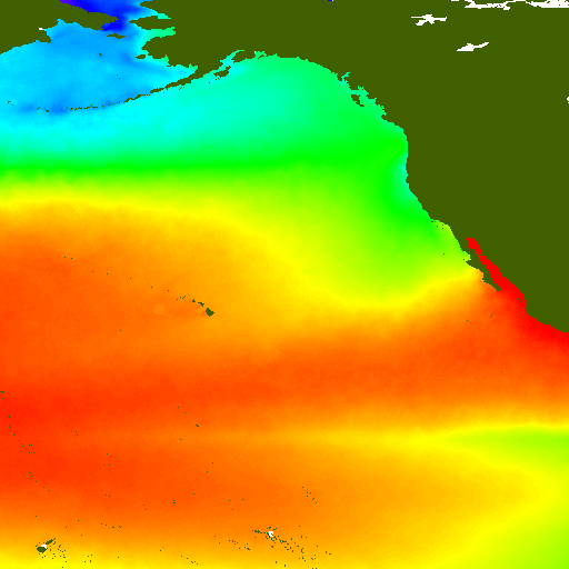
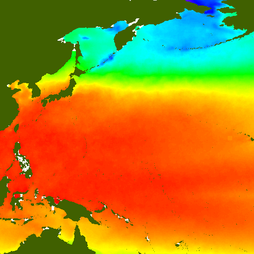
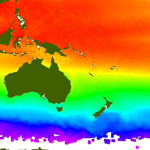
| Units: | Degrees centigrade (calculated from the pixel value by the formula T = -2.1 + 0.2 * p where p is the pixel value. |
| Resolution: | 1 |
| Range of values | |
|---|---|
| Minimum: | -10783 |
| Maximum: | 8000 |
| Units: | meters |
| Resolution: | 1 |
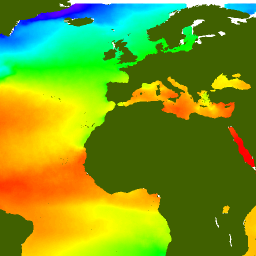
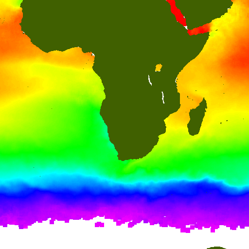
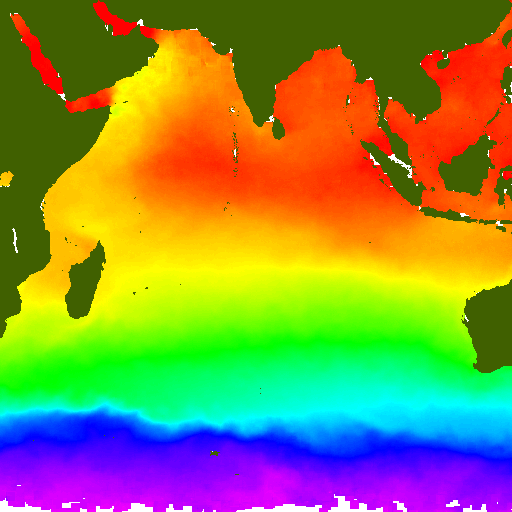
The purpose of this data set is to provide paleoclimate researchers with a tool for estimating the average seasonal variation in sea-surface temperature (SST) throughout the modern world ocean and for estimating the modern monthly and weekly sea-surface temperature at any given oceanic location. It is expected that these data will be compared with temperature estimates derived from geological proxy measures such as faunal census analyses and stable isotopic analyses. The results can then be used to constrain general circulation models of climate change.
Online Links:
Are there legal restrictions on access or use of the data?Access_Constraints: none
Use_Constraints: none
Although all data and software published on this CD-ROM have been used by the USGS, no warranty, expressed or implied, is made by the USGS as to the accuracy of the data and related materials or the functioning of the software. The act of distribution shall not constitute any such warranty, and no responsibility is assumed by the USGS in the use of these data, software, or related materials.
| Data format: | Sea-Surface Temperature in format starkit Stand-alone runtime (Tcl/Tk starkit, platform independent, requires tclkit to run) Size: 7.5 |
|---|---|
| Network links: |
http://geo-nsdi.er.usgs.gov/metadata/digital-data/10/sst.kit |
| Data format: | Sea-Surface Temperature in format GIF (version 89a) Size: 7 |
|---|---|
| Network links: |
http://geo-nsdi.er.usgs.gov/metadata/digital-data/10/dds10.zip |
| Data format: | Sea-Surface Temperature display application in format EXE Stand-alone runtime (Tcl/Tk starpack executable, UPX compressed) for Microsoft Windows Size: 7.5 |
|---|---|
| Network links: |
http://geo-nsdi.er.usgs.gov/metadata/digital-data/10/sst.exe |
| Data format: | Sea-Surface Temperature display application in format ELF Stand-alone runtime (Tcl/Tk starpack executable, UPX compressed) for Linux x86 Size: 7.5 |
|---|---|
| Network links: |
http://geo-nsdi.er.usgs.gov/metadata/digital-data/10/sst.bin |
| Data format: | Sea-Surface Temperature display application in format Disk image Compressed disk image containing the application for Mac OSX Size: 7.5 |
|---|---|
| Network links: |
http://geo-nsdi.er.usgs.gov/metadata/digital-data/10/sst-viewer.dmg.gz |