Citation:
Citation_Information:
Originator: Brabb, E.E.
Originator: Graymer, R.W.
Originator: Jones, D.L.
Publication_Date: 1998
Title:
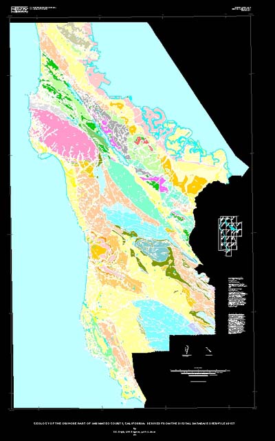
Geology of the onshore part of San Mateo County, California: A digital database
Geospatial_Data_Presentation_Form: map
Series_Information:
Series_Name: U.S. Geological Survey Open-File Report
Issue_Identification: 98-137
Publication_Information:
Publication_Place: Menlo Park, CA
Publisher: U.S. Geological Survey
Online_Linkage: http://pubs.usgs.gov/of/1998/of98-137/
Description:
Abstract:
This digital map database, compiled from previously published and
unpublished data, and new mapping by the authors, represents the
general distribution of bedrock and surficial deposits in San Mateo
County. Together with the accompanying text, it provides current
information on the geologic stucture and stratigraphy of the area
covered. The database delineates map units that are identified by
general age and lithology following the stratigraphic nomenclature
of the U.S. Geological Survey. The scale of the source maps limits
the spatial resolution (scale) of the database to 1:62,500 or smaller.
Purpose:
This map is intended to be of general use to engineers and land-use
planners. However, its small scale does not provide sufficient
detail for site development purposes. In addition, this map does not
take the place of fault-rupture hazard zones designated by the
California State Geologist (Hart, 1988). Similarly, the database
cannot be used to identify or delineate landslides in the region.
For a depiction of landslide distribution, see Brabb and Pampeyan
(1972), Brabb and others (1978), Mark (1992), Wieczorek and others
(1985), and Wieczorek and others (1988).
Supplemental_Information:
Additional information is available in two textual reports:
smgeo.ps is a PostScript report containing detailed unit
descriptions and geological information, sources of data
and cited references. The text is available in smgeo.txt.
smdb.ps is a PostScript report describing the structure of
the database. The text is available in smdb.txt.
ARC/INFO coverages
sm_um-py.e00
  Faults, depositional contacts, and rock units in San Mateo County
sm_um-sr.e00
  Strike and dip information and fold axes in San Mateo County
sm_quad.e00
  Index map of quadrangles in San Mateo County.
sm_um-flt.e00
  Index map of faults in San Mateo County with annotation showing the names of major faults.
sm_corr.e00
  Correlation table for the units in this map database.
sm_so.e00
  Sources of data index map for this map database.
sm_as.e00
  Index map of Assemblages in San Mateo County.  (Assemblages are described in smgeo.txt or smgeo.ps)
sm_um-dr.e00
  Drainage base map (from 1:100,000 scale original).
sm_um-cu.e00
  Cultural base map (from 1:100,000 scale original).
sm_um-topo.e00
  Topographic contours base map (from 1:100,000 scale original).
Data_Set_Structure:
Data_Set_Part:
Part_Type: ARC/INFO coverage
Part_Name: sm_um-py.e00
Part_Description: Faults, depositional contacts, and rock units in San Mateo County
Data_Set_Part:
Part_Type: ARC/INFO coverage
Part_Name: sm_um-sr.e00
Part_Description: Strike and dip information and fold axes in San Mateo County
Data_Set_Part:
Part_Type: ARC/INFO coverage
Part_Name: sm_quad.e00
Part_Description: Index map of quadrangles in San Mateo County.
Data_Set_Part:
Part_Type: ARC/INFO coverage
Part_Name: sm_um-flt.e00
Part_Description:
Index map of faults in San Mateo County with annotation showing the names of
major faults.
Data_Set_Part:
Part_Type: ARC/INFO coverage
Part_Name: sm_corr.e00
Part_Description: Correlation table for the units in this map database.
Data_Set_Part:
Part_Type: ARC/INFO coverage
Part_Name: sm_so.e00
Part_Description: Sources of data index map for this map database.
Data_Set_Part:
Part_Type: ARC/INFO coverage
Part_Name: sm_as.e00
Part_Description:
Index map of Assemblages in San Mateo County. (Assemblages are described in
smgeo.txt or smgeo.ps)
Data_Set_Part:
Part_Type: ARC/INFO coverage
Part_Name: sm_um-dr.e00
Part_Description: Drainage base map (from 1:100,000 scale original).
Data_Set_Part:
Part_Type: ARC/INFO coverage
Part_Name: sm_um-cu.e00
Part_Description: Cultural base map (from 1:100,000 scale original).
Data_Set_Part:
Part_Type: ARC/INFO coverage
Part_Name: sm_um-topo.e00
Part_Description: Topographic contours base map (from 1:100,000 scale original).
Time_Period_of_Content:
Time_Period_Information:
Single_Date/Time:
Calendar_Date: 1998
Currentness_Reference:
Date given is publication date. Age of the rocks described
in this map ranges from Jurassic through Holocene, with some
occurrence of metamorphic rocks thought to be Paleozoic.
Status:
Progress: Complete
Maintenance_and_Update_Frequency:
Irregular. The USGS Open-File Reports are used for rapid release
of information to the public; this map will likely be superseded
by one in the more formal Miscellaneous Investigations map series
in the next few years.
Spatial_Domain:
Bounding_Coordinates:
West_Bounding_Coordinate: -122.554
East_Bounding_Coordinate: -122.075
North_Bounding_Coordinate: 37.717
South_Bounding_Coordinate: 37.100
Keywords:
Theme:
Theme_Keyword_Thesaurus: USGS Thesaurus
Theme_Keyword: geology
Theme_Keyword: geologic maps
Theme_Keyword: bedrock geologic units
Theme_Keyword: surficial geologic units
Theme_Keyword: geologic structure
Theme_Keyword: faulting (geologic)
Theme_Keyword: geospatial datasets
Place:
Place_Keyword_Thesaurus: GNIS
Place_Keyword: San Mateo County, CA
Place_Keyword: California
Stratum:
Stratum_Keyword_Thesaurus: None
Stratum_Keyword: Anchor Bay Conglomerate
Stratum_Keyword: Butano Sandstone
Stratum_Keyword: Colma Formation
Stratum_Keyword: Franciscan Complex
Stratum_Keyword: Ladera Sandstone
Stratum_Keyword: Lambert Shale
Stratum_Keyword: Lobitos Mudstone Member
Stratum_Keyword: Lompico Sandstone
Stratum_Keyword: Merced Formation
Stratum_Keyword: Mindego Basalt
Stratum_Keyword: Monterey Formation
Stratum_Keyword: Page Mill Basalt
Stratum_Keyword: Pigeon Point Formation
Stratum_Keyword: Pomponio Mudstone Member
Stratum_Keyword: Purisima Formation
Stratum_Keyword: Rices Mudstone Member
Stratum_Keyword: San Gregorio Sandstone Member
Stratum_Keyword: San Lorenzo Formation
Stratum_Keyword: Santa Clara Formation
Stratum_Keyword: Santa Cruz Mudstone
Stratum_Keyword: Santa Margarita Sandstone
Stratum_Keyword: Tahana Member
Stratum_Keyword: Tunitas Sandstone Member
Stratum_Keyword: Twobar Shale Member
Stratum_Keyword: Vaqueros Sandstone
Stratum_Keyword: Whiskey Hill Formation
Temporal:
Temporal_Keyword_Thesaurus: None
Temporal_Keyword: Jurassic
Temporal_Keyword: Cretaceous
Temporal_Keyword: Tertiary
Temporal_Keyword: Paleocene
Temporal_Keyword: Eocene
Temporal_Keyword: Oligocene
Temporal_Keyword: Miocene
Temporal_Keyword: Pliocene
Temporal_Keyword: Quaternary
Temporal_Keyword: Holocene
Theme:
Theme_Keyword_Thesaurus: National Geologic Map Database Catalog themes, augmented
Theme_Keyword: 2100 - Transportation
Theme_Keyword: 2101 - Roads
Theme_Keyword: 2102 - Railroads
Theme_Keyword: 2500 - Political Boundaries
Theme_Keyword: 2502 - County Boundaries
Theme_Keyword: 2503 - City Boundaries or Locations
Theme_Keyword: 2200 - Hydrography
Theme_Keyword: 2201 - Streams
Theme_Keyword: 2202 - Lakes
Theme_Keyword: 2203 - Coastline
Theme_Keyword: 2600 - Topography
Theme_Keyword: 2601 - Contours
Theme_Keyword: 1100 - Geology
Theme_Keyword: 1101 - General
Theme:
Theme_Keyword_Thesaurus: ISO 19115 Topic Categories
Theme_Keyword: geoscientificInformation
Place:
Place_Keyword_Thesaurus: Augmented FIPS 10-4 and FIPS 6-4
Place_Keyword: f06081 = San Mateo
Access_Constraints: None
Use_Constraints: None
Point_of_Contact:
Contact_Information:
Contact_Organization_Primary:
Contact_Organization: USGS Western Geologic Mapping Team
Contact_Person: Russ Graymer
Contact_Address:
Address_Type: mailing and physical address
Address: 345 Middlefield Road, MS 975
City: Menlo Park
State_or_Province: CA
Postal_Code: 94025
Country: USA
Contact_Voice_Telephone: 650-329-4921
Contact_Electronic_Mail_Address: [email protected]
Browse_Graphic:
Browse_Graphic:
Browse_Graphic_File_Name: http://pubs.usgs.gov/of/1998/of98-137/smmap.pdf
Browse_Graphic_File_Description:
A PDF representation of the Quaternary geologic map and base maps
of San Mateo County and surrounding areas at a scale of 1:62,500
(Sheet 1). 5.5 megabytes.
Browse_Graphic_File_Type: PDF
Browse_Graphic:
Data_Set_Credit:
We are grateful to the following U.S. Geological Survey
paleontologists who have examined our fossils and provided ages
necessary to establish the stratigraphic sequence and structure:
David Bukry (Cretaceous and Tertiary nannoplankton), Kristin
McDougall (Tertiary foraminifers), Willam Sliter (deceased -
Cretaceous and Eocene foraminifers), John Barron (Tertiary
diatoms), Charles Powell II (Tertiary mollusks), and Bonita
Murchey (Mesozoic radiolaria).
We are also very grateful to managers and staff of Chevron,
EXXON, UNOCAL, ARCO, and Shell Petroleum Companies who have
provided reports, maps, picked slides, and residues for about
25,000 microfossil localities in the San Francisco Bay Region.
We are grateful to Tracey Felger, who made the original scan and
a preliminary edit of author materials; to Judy Mariant, who did
additional editing and tagging of lines; and to Dominique
Garnier, who digitized many of the bedding attitudes. Carl
Wentworth kindly provided advice on digitizing and editing
procedures. Ed Helley provided materials and advice on
Quaternary units.
Native_Data_Set_Environment:
The databases in this repot were compiled in ARC/INFO, a commercial
Geographic Information System (Environmental Systems Research
Institute, Redlands, California), with version 3.0 of the menu
interface ALACARTE (Fitzgibbon and Wentworth, 1991, Fitzgibbon,
1991, Wentworth and Fitzgibbon, 1991). The files are in either
GRID (ARC/INFO raster data) format or COVERAGE (ARC/INFO vector
data) format. Coverages are stored in uncompressed ARC export
format (ARC/INFO version 7.x). ARC/INFO export files (files with
the .e00 extension) can be converted into ARC/INFO coverages in
ARC/INFO (see below) and can be read by some other Geographic
Information Systems, such as MapInfo via ArcLink and ESRI's ArcView
(version 1.0 for Windows 3.1 to 3.11 is available for free from
ESRI's web site:
http://www.esri.com/ ). The digital compilation was
done in version 7.0.4 of ARC/INFO with version 3.0 of the menu
interface ALACARTE (Fitzgibbon and Wentworth, 1991, Fitzgibbon,
1991, Wentworth and Fitzgibbon, 1991). The PostScript plotfiles
for maps were produced by the "postscript" command with compression
set to zero in ARC/INFO version 7.0.4. The PostScript plotfiles
for pamphlets were produced in Microsoft Word 6.0 using the
Destination PostScript File option from the Print command.