Citation:
Citation_Information:
Originator: Howard G. Wilshire (author)
Originator: David R. Bedford (digital compiler)
Originator: Teresa Coleman (digital compiler)
Publication_Date: 2002
Title:
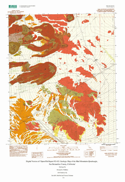
Digital Version of 'Open-File Report 92-182: Geologic Map of the Marl Mountains Quadrangle, San Bernardino County, California'
Edition: 1
Geospatial_Data_Presentation_Form: vector digital data
Series_Information:
Series_Name: U.S. Geological Survey Open-File Report
Issue_Identification: 02-271
Publication_Information:
Publication_Place: Menlo Park, California
Publisher: U.S. Geological Survey
Online_Linkage: http://pubs.usgs.gov/of/2002/0271/
Description:
Abstract:
This is a digital map database version of a previous U.S.
Geological Survey Open-File Report, OF92-182. It contains 3
Arc/Info formatted coverages, distributed in Arc Interchange
format, a plottable map representation of the database at
1:24,000 scale in Postscript and Adobe PDF formats, and the
original map explanation pamphlet in text, Postscript, and
Adobe PDF formats.
Purpose:
The purpose of this dataset is to archive previous geologic
mapping in the area and to enable the further use,
reclassification, and analysis of existing geologic map data
in the area.
Time_Period_of_Content:
Time_Period_Information:
Single_Date/Time:
Calendar_Date: 1992
Currentness_Reference: publication date of original report
Status:
Progress: Complete
Maintenance_and_Update_Frequency: None planned
Spatial_Domain:
Bounding_Coordinates:
West_Bounding_Coordinate: -115.752747
East_Bounding_Coordinate: -115.623724
North_Bounding_Coordinate: 35.251339
South_Bounding_Coordinate: 35.123634
Keywords:
Theme:
Theme_Keyword_Thesaurus: USGS Thesaurus
Theme_Keyword: geology
Theme_Keyword: geologic maps
Theme_Keyword: bedrock geologic units
Theme_Keyword: surficial geologic units
Theme_Keyword: geologic structure
Theme_Keyword: geospatial datasets
Theme:
Theme_Keyword_Thesaurus: ISO 19115 Topic Categories
Theme_Keyword: geoscientificInformation
Place:
Place_Keyword_Thesaurus: none
Place_Keyword: Marl Mountains
Place_Keyword: San Bernardino County
Place_Keyword: Mojave Desert
Place:
Place_Keyword_Thesaurus: Augmented FIPS 10-4 and FIPS 6-4
Place_Keyword: f06071 = San Bernardino
Access_Constraints: None
Use_Constraints:
Acknowledgement of the U.S. Geological Survey; Uses of this digital geologic map should not violate the spatial resolution of the data. Although the digital form of the data removes the constraint imposed by the scale of a paper map, the detail and accuracy inherent in map scale are also present in the digital data. The fact that this database was edited at a scale of 1:24,000 means that higher resolution information is not present in the dataset. Plotting at scales larger than 1:24,000 will not yield greater real detail, although it may reveal fine-scale irregularities below the intended resolution of the database. Similarly, where this database is used in combination with other data of higher resolution, the resolution of the combined output will be limited by the lower resolution of these data.
Point_of_Contact:
Contact_Information:
Contact_Person_Primary:
Contact_Person: David Bedford
Contact_Organization: U.S. Geological Survey
Contact_Position: Geologist
Contact_Address:
Address_Type: mailing and physical address
Address: 345 Middlefield Rd, MS 975
City: Menlo Park
State_or_Province: CA
Postal_Code: 94025
Country: USA
Contact_Voice_Telephone: 650-329-4924
Contact_Facsimile_Telephone: 650-329-4936
Contact_Electronic_Mail_Address: [email protected]
Browse_Graphic:
Native_Data_Set_Environment:
Microsoft Windows 2000 Version 5.0 (Build 2195) Service Pack 1, RC 1.1; ESRI ArcCatalog 8.1.0.570