Citation:
Citation_Information:
Originator: Douglas M. Morton
Originator: C. H. Gray, Jr.
Publication_Date: 2002
Title:
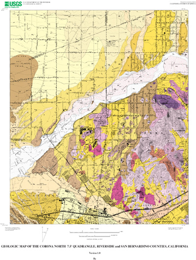
Geologic Map of the Corona North 7.5' Quadrangle, Riverside and San Bernardino Counties, California
Edition: Version 1.0
Geospatial_Data_Presentation_Form: vector digital data
Series_Information:
Series_Name: U.S. Geological Survey Open-File Report
Issue_Identification: 02-22
Publication_Information:
Publication_Place: Menlo Park, California
Publisher: U.S. Geological Survey
Online_Linkage: http://pubs.usgs.gov/of/2002/0022/
Description:
Abstract:
This data set maps and describes the geology of the Corona North 7.5' quadrangle, Riverside and San Bernardino Counties, California. Created using Environmental Systems Research Institute's ARC/INFO software, the data base consists of the following items: (1) a map coverage containing geologic contacts and units, (2) a coverage containing structural data, (3) a coverage containing geologic unit annotation and leaders, and (4) attribute tables for geologic units (polygons), contacts (arcs), and site-specific data (points). In addition, the data set includes the following graphic and text products: (1) a postscript graphic plot-file containing the geologic map, topography, cultural data, a Correlation of Map Units (CMU) diagram, a Description of Map Units (DMU), and a key for point and line symbols, and (2) PDF files of the Readme (including the metadata file as an appendix), and the graphic produced by the Postscript plot file.
The Corona North quadrangle is located near the northern end of the Peninsular Ranges Province. All but the southeastern tip of the quadrangle is within the Perris block, a relatively stable, rectangular in plan area located between the Elsinore and San Jacinto fault zones. The southeastern tip of the quadrangle is barely within the Elsinore fault zone.
The quadrangle is underlain by Cretaceous plutonic rocks that are part of the composite Peninsular Ranges batholith. These rocks are exposed in a triangular-shaped area bounded on the north by the Santa Ana River and on the south by Temescal Wash, a major tributary of the Santa Ana River. A variety of mostly silicic granitic rocks occur in the quadrangle, and are mainly of monzogranite and granodioritic composition, but range in composition from micropegmatitic granite to gabbro. Most rock units are massive and contain varying amounts of meso- and melanocratic equant-shaped inclusions. The most widespread granitic rock is monzogranite of the Cajalco pluton, a large pluton that extends some distance south of the quadrangle. North of Corona is a body of micropegmatite that appears to be unique in the batholith rocks.
Diagonally bisecting the quadrangle is the Santa Ana River. North of the Santa Ana River alluvial deposits are dominated by the distal parts of alluvial fans emanating from the San Gabriel Mountains north of the quadrangle. Widespread areas of the fan deposits are covered by a thin layer of wind blown sand.
Alluvial deposits in the triangular-shaped area between the Santa Ana River and Temescal Wash are quite varied, but consist principally of locally derived older alluvial fan deposits. These deposits rest on remnants of older, early Quaternary or late Tertiary age, nonmarine sedimentary deposits that were derived from both local sources and sources as far away as the San Bernardino Mountains. These deposits in part were deposited by an ancestral Santa Ana River. Older are a few scattered remnants of late Tertiary (Pliocene) marine sandstone that include some conglomerate lenses. Clasts in the conglomerate include siliceous volcanic rocks exotic to this part of southern California. This sandstone was deposited as the southeastern-most part of the Los Angeles sedimentary marine basin and was deposited along a rocky shoreline developed in the granitic rocks, much like the present day shoreline at Monterey, California. Most of the sandstone and granitic paleoshoreline features have been removed by quarrying and grading in the area of Porphyry north to Highway 91. Excellent exposures in highway road cuts still remain on the north side of Highway 91 just east of the 91-15 interchange and on the east side of U.S. 15 just north of the interchange.
South of Temescal Wash is a series of both younger and older alluvial fan deposits emanating from the Santa Ana Mountains to the southeast. In the immediate southwest corner of the quadrangle is a small exposure of sandstone and pebble conglomerate of the Sycamore Canyon member of the Puente Formation of early Pliocene and Miocene age and sandstone and conglomerate of undivided Sespe and Vaqueros Formations of early Miocene, Oligocene, and late Eocene age.
The geologic map data base contains original U.S. Geological Survey data generated by detailed field observation recorded on 1:24,000 scale aerial photographs. The map was created by transferring lines from the aerial photographs to a 1:24,000 scale topographic base. The map was digitized and lines, points, and polygons were subsequently edited using standard ARC/INFO commands. Digitizing and editing artifacts significant enough to display at a scale of 1:24,000 were corrected. Within the database, geologic contacts are represented as lines (arcs), geologic units are polygons, and site-specific data as points. Polygon, arc, and point attribute tables (.pat, .aat, and .pat, respectively) uniquely identify each geologic datum.
Purpose:
The data set for the Corona North 7.5' quadrangle was prepared under the U.S. Geological Survey Southern California Areal Mapping Project (SCAMP) as part of an ongoing effort to develop a regional geologic framework of southern California, and to utilize a Geographic Information System (GIS) format to create regional digital geologic databases. These regional databases are being developed as contributions to the National Geologic Map Database of the National Cooperative Geologic Mapping Program of the USGS.
Time_Period_of_Content:
Time_Period_Information:
Single_Date/Time:
Calendar_Date: 2002
Currentness_Reference: publication date
Status:
Progress: Complete
Maintenance_and_Update_Frequency: As Needed
Spatial_Domain:
Bounding_Coordinates:
West_Bounding_Coordinate: -117.6250914
East_Bounding_Coordinate: -117.4999086
North_Bounding_Coordinate: 33.99999995
South_Bounding_Coordinate: 33.87498415
Keywords:
Theme:
Theme_Keyword_Thesaurus: USGS Thesaurus
Theme_Keyword: geology
Theme_Keyword: geologic maps
Theme_Keyword: bedrock geologic units
Theme_Keyword: surficial geologic units
Theme_Keyword: geologic structure
Theme_Keyword: geospatial datasets
Theme:
Theme_Keyword_Thesaurus: ISO 19115 Topic Categories
Theme_Keyword: geoscientificInformation
Place:
Place_Keyword_Thesaurus: none
Place_Keyword: California
Place_Keyword: Riverside County
Place_Keyword: San Bernardino County
Place_Keyword: Corona North 7.5' quadrangle
Place:
Place_Keyword_Thesaurus: Augmented FIPS 10-4 and FIPS 6-4
Place_Keyword: f06065 = Riverside
Place_Keyword: f06071 = San Bernardino
Stratum:
Stratum_Keyword_Thesaurus: None
Stratum_Keyword: Cretaceous tonalite and granodiorite
Stratum_Keyword: Tertiary marine sedimentary rocks
Stratum_Keyword: Quaternary deposits
Temporal:
Temporal_Keyword_Thesaurus: None
Temporal_Keyword: Cretaceous
Temporal_Keyword: late Tertiary
Temporal_Keyword: Quaternary
Access_Constraints: None
Use_Constraints:
The Corona North 7.5' geologic-map database should be used to evaluate and understand the geologic character of the Corona North 7.5' quadrangle as a whole. The data should not be used for purposes of site-specific land-use planning or site-specific geologic evaluations. The database is sufficiently detailed to identify and characterize many actual and potential geologic hazards represented by faults and landslides and posed by ground subsidence and earthquake-generated ground shaking. However, it is not sufficiently detailed for site-specific determinations or evaluations of these features. Faults shown do not take the place of fault-rupture hazard zones designated by the California State Geologist (see Hart, 1988).
Use of this digital geologic-map database should not violate the spatial resolution of the data. Although the digital form of the data removes the constraint imposed by the scale of a paper map, the detail and accuracy inherent in map scale are also present in the digital data. The fact that this database was compiled and edited at a scale of 1:24,000 means that higher resolution information may not have been uniformly retained in the dataset. Plotting at scales larger than 1:24,000 will not yield greater real detail, although it may reveal fine-scale irregularities below the intended resolution of the database. Similarly, although higher resolution data is incorporated in most of the map, the resolution of the combined output will be limited by the lower resolution data.
Point_of_Contact:
Contact_Information:
Contact_Person_Primary:
Contact_Person: Douglas M. Morton
Contact_Organization:
U.S. Geological Survey, Western Region, Earth Surface Processes Team
Contact_Position: Project geologist
Contact_Address:
Address_Type: mailing address
Address:
U.S. Geological Survey
Department of Earth Sciences
University of California, Riverside
City: Riverside
State_or_Province: California
Postal_Code: 92521
Country: United States of America
Contact_Voice_Telephone: (909) 276-6397
Contact_Facsimile_Telephone: (909) 276-6295
Contact_Electronic_Mail_Address: [email protected]
Browse_Graphic:
Data_Set_Credit:
Geologic mapping and digital preparation of this report were sponsored jointly by (1) the National Cooperative Geologic Mapping Program of the U.S. Geological Survey, (2) the California Division of Mines and Geology, and (3) the Southern California Areal Mapping Project (SCAMP).
Native_Data_Set_Environment:
SunOS, 5.8, sun4m UNIX
ARC/INFO version 7.2.1
Cross_Reference:
Citation_Information:
Originator: Morton, D.M.
Publication_Date: 1999
Title:
Preliminary digital geologic map of the Santa Ana 30'x60' quadrangle, southern California, version 1.0.
Geospatial_Data_Presentation_Form: vector digital data
Series_Information:
Series_Name: U.S. Geological Survey Open-File Report
Issue_Identification: 99-172
Publication_Information:
Publication_Place: California
Publisher: U.S. Geological Survey
Online_Linkage: http://pubs.usgs.gov/of/1999/of99-172/