Citation:
Citation_Information:
Originator: Robert C. Bucknam
Originator: Jeffrey A. Coe
Originator: Manuel Antonio Mota
Publication_Date: 2001
Title: Landslide initiation locations in Juyamá quadrangle, Guatemala
Geospatial_Data_Presentation_Form: vector digital data
Series_Information:
Series_Name: U.S. Geological Survey Open-File Report
Issue_Identification: 01-443
Publication_Information:
Publication_Place: Denver, CO
Publisher: U.S. Geological Survey
Online_Linkage: http://pubs.usgs.gov/of/2001/ofr-01-0443/
Larger_Work_Citation:
Citation_Information:
Originator: Robert C. Bucknam
Originator: Jeffrey A. Coe
Originator: Manuel Antonio Mota
Originator: Jonathan W. Godt
Originator: Arthur C. Tarr
Originator: Lee-Ann Bradley
Originator: Sharon Rafferty
Originator: Dean Hancock
Originator: Richard L. Dart
Originator: Margo L. Johnson
Publication_Date: 2001
Title:
Landslides Triggered by Hurricane Mitch in Guatemala - Inventory and Discussion
Series_Information:
Series_Name: U.S. Geological Survey Open-File Report
Issue_Identification: 01-443
Publication_Information:
Publication_Place: Denver, Colorado
Publisher: U.S. Geological Survey
Online_Linkage: http://pubs.usgs.gov/of/2001/ofr-01-0443/
Description:
Abstract:
This cover contains initiation location of landslides formed during Hurricane Mitch in October - November 1998. Locations were identified by manually selecting the upslope location of the landslides in the cover ls23622.
Purpose:
The cover shows the distribution of slope failures formed during Hurricane Mitch in one of twenty 1:50,000-scale maps within a large study area adjacent to the Motagua and Polochic Rivers.
Time_Period_of_Content:
Time_Period_Information:
Range_of_Dates/Times:
Beginning_Date: 199810
Ending_Date: 199811
Currentness_Reference: ground condition
Status:
Progress: Complete
Maintenance_and_Update_Frequency: None planned
Spatial_Domain:
Bounding_Coordinates:
West_Bounding_Coordinate: -88.961281
East_Bounding_Coordinate: -88.894247
North_Bounding_Coordinate: 15.286314
South_Bounding_Coordinate: 15.172094
Keywords:
Theme:
Theme_Keyword_Thesaurus: USGS Thesaurus
Theme_Keyword: geology
Theme_Keyword: landslides
Theme_Keyword: hurricanes
Theme_Keyword: precipitation (atmospheric)
Theme_Keyword: geospatial datasets
Theme:
Theme_Keyword_Thesaurus: ISO 19115 Topic Categories
Theme_Keyword: geoscientificInformation
Place:
Place_Keyword_Thesaurus: none
Place_Keyword: Guatemala
Place:
Place_Keyword_Thesaurus: Augmented FIPS 10-4 and FIPS 6-4
Place_Keyword: GT = Guatemala
Temporal:
Temporal_Keyword: October 1998 - November 1998
Access_Constraints: None
Use_Constraints:
These maps are inventory maps, not hazard maps, and should not be enlarged to a scale larger than 1:50,000.
Point_of_Contact:
Contact_Information:
Contact_Person_Primary:
Contact_Person: Jeffrey A Coe
Contact_Organization: U.S. Geological Survey, CR
Contact_Position: Hydrologist
Contact_Address:
Address_Type: mailing address
Address:
Mail Stop 966
P.O. Box 25046
City: Lakewood
State_or_Province: CO
Postal_Code: 80225
Country: USA
Contact_Voice_Telephone: 303-273-8606
Contact_Facsimile_Telephone: 303-273-8600
Contact_Electronic_Mail_Address: [email protected]
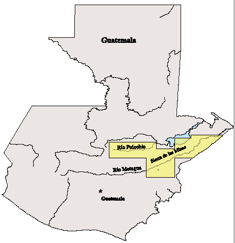
Browse_Graphic:
Browse_Graphic_File_Name:
Browse_Graphic_File_Description:
Index map showing general area of landslide assessment, 462x476 pixels, 9k bytes.
Browse_Graphic_File_Type: PNG
Data_Set_Credit:
This report is based on a cooperative study by the U.S. Geological
Survey, Denver, Colorado and the Instituto Nacional de Sismologia,
Vulcanologia, Meteorologia e Hidrologia, Guatemala City, Guatemala.
Work funded by the U.S. Agency for International Development's
Hurricane Mitch Reconstruction Program.
Native_Data_Set_Environment:
Microsoft Windows 2000 Version 5.0 (Build 2195) Service Pack 2; ESRI ArcCatalog 8.1.1.649