Geologic Map and Digital Database of the Cougar Buttes 7.5' Quadrangle, San Bernardino County, California

Metadata also available as - [Questions & Answers] - [Parseable text] - [XML]

Metadata:

Identification_Information:
Citation:
Citation_Information:
Originator: Robert E. Powell
Originator: Jonathan C. Matti
Originator: Pamela M. Cossette (digital compiler)
Publication_Date: 2000301
Title:
Geologic Map and Digital Database of the Cougar Buttes 7.5' Quadrangle, San Bernardino County, California
Edition: Version 1.0
Geospatial_Data_Presentation_Form: vector digital data
Series_Information:
Series_Name: U.S. Geological Survey Open-File Report
Issue_Identification: 00-175
Publication_Information:
Publication_Place: Menlo Park, California
Publisher: U.S. Geological Survey
Online_Linkage: http://pubs.usgs.gov/of/2000/0175/
Description:
Abstract:
This data set maps and describes the geology of the Cougar Buttes 7.5' quadrangle, San Bernardino County, California. Created using Environmental Systems Research Institute's ARC/INFO software, the data base consists of the following items: (1) a map coverage showing geologic contacts and units, (2) a separate coverage layer showing structural data, (3) a scanned topographic base at a scale of 1:24,000, and (4) attribute tables for geologic units (polygons), contacts (arcs), and site-specific data (points). The data base is accompanied by a readme file and this metadata file. In addition, the data set includes the following graphic and text products: (1) A portable document file (.pdf) containing a browse-graphic of the geologic map on a 1:24,000 topographic base. The map is accompanied by a marginal explanation consisting of a Description of Map Units (DMU), a Correlation of Map Units (CMU), and a key to point and line symbols. (2) Separate .pdf files of the DMU and CMU, individually. (3) A PostScript graphic plot-file containing the geologic map on a 1:24,000 topographic base accompanied by the marginal explanation. (4) A pamphlet that summarizes the late Cenozoic geology of the Cougar Buttes quadrangle.
The geologic map data base contains original U.S. Geological Survey data generated by detailed field observation and by interpretation of aerial photographs, including low-altitude color and black-and-white photographs and high-altitude infrared photographs. The map was created by transferring lines from the aerial photographs to a 1:24,000 topographic base via a mylar orthophoto-quadrangle or by using a PG-2 plotter. The map was then scribed, scanned, and imported into ARC/INFO, where the database was built. Within the database, geologic contacts are represented as lines (arcs), geologic units as polygons, and site-specific data as points. Polygon, arc, and point attribute tables (.pat, .aat, and .pat, respectively) uniquely identify each geologic datum and link it to other tables (.rel) that provide more detailed geologic information.
Purpose:

The data set for the Cougar Buttes quadrangle has been prepared by the Southern California Areal Mapping Project (SCAMP), a cooperative project sponsored jointly by the U.S. Geological Survey and the California Division of Mines and Geology, as part of an ongoing effort to utilize a Geographical Information System (GIS) format to create a regional digital geologic database for southern California. This regional database is being developed as a contribution to the National Geologic Map Data Base of the National Cooperative Geologic Mapping Program of the USGS. Development of the data set for the Cougar Buttes quadrangle has also been supported by the Mojave Water Agency and U.S. Forest Service, San Bernardino National Forest.
The digital geologic map database for the Cougar Buttes quadrangle has been created as a general-purpose data set that is applicable to other land-related investigations in the earth and biological sciences. In cooperation with the Water Resources Division of the U.S. Geological Survey, we have used our mapping in the Cougar Buttes and adjoining quadrangles together with well log data to develop a hydrogeologic framework for the basin. In an effort to understand surficial processes and to provide a base suitable for ecosystem assessment, we have differentiated surficial veneers on piedmont and pediment surfaces and distinguished the various substrates found beneath these veneers. Currently, the geologic database for the Cougar Buttes quadrangle is being applied in groundwater investigations in the Lucerne Valley basin (USGS, Water Resources Division), in biological species studies of the Cushenbury Canyon area (U.S. Forest Service, San Bernardino National Forest), and in the study of soils on various Quaternary landscape surfaces on the north piedmont of the San Bernardino Mountains (University of New Mexico). The Cougar Buttes database is not suitable for site-specific geologic evaluations at scales greater than 1:24,000 (1 in = 2,000 ft).
Time_Period_of_Content:
Time_Period_Information:
Single_Date/Time:
Calendar_Date: 2000
Currentness_Reference: New data

Status:
Progress: Complete
Maintenance_and_Update_Frequency: As needed

Spatial_Domain:
Bounding_Coordinates:
West_Bounding_Coordinate: -116.87509313
East_Bounding_Coordinate: -116.74990687
North_Bounding_Coordinate: 34.49999995
South_Bounding_Coordinate: 34.37498407

Keywords:
Theme:
Theme_Keyword_Thesaurus: USGS Thesaurus
Theme_Keyword: geology
Theme_Keyword: geologic maps
Theme_Keyword: surficial geologic units
Theme_Keyword: bedrock geologic units
Theme_Keyword: geologic structure
Theme_Keyword: geospatial datasets
Theme:
Theme_Keyword_Thesaurus: ISO 19115 Topic Categories
Theme_Keyword: geoscientificInformation
Theme:
Theme_Keyword_Thesaurus: National Geologic Map Database Catalog themes, augmented
Theme_Keyword: 3100 - Vector
Theme_Keyword: 3110 - ESRI
Theme_Keyword: 3111 - coverage
Theme_Keyword: 1100 - Geology
Theme_Keyword: 1101 - General
Place:
Place_Keyword_Thesaurus: none
Place_Keyword: California

Place_Keyword: San Bernardino County
Place_Keyword: Cougar Buttes 7.5' quadrangle
Place:
Place_Keyword_Thesaurus: Augmented FIPS 10-4 and FIPS 6-4
Place_Keyword: f06071 = San Bernardino
Access_Constraints: None

Use_Constraints:
The Cougar Buttes 7.5' geologic-map database should be used to evaluate and understand the geologic character of the Cougar Buttes quadrangle as a whole. The data should not be used for purposes of site-specific land-use planning or site-specific geologic evaluations. The database is sufficiently detailed to identify and characterize many actual and potential geologic hazards represented by faults and landslides. However, it is not sufficiently detailed for site-specific determinations or evaluations of those features. Faults shown do not take the place of fault-rupture hazard zones designated by the California State Geologist (see Hart, 1988).
Use of the Cougar Buttes geologic-map database should not violate the spatial resolution of the data. Although the digital form of the data removes the constraint imposed by the scale of any derivative maps, the detail and accuracy issues inherent in map scale limitations are also present in the digital data. The fact that this database was edited at a scale of 1:24,000 means that higher-resolution data generally are not present in the dataset. Plotting at scales larger than 1:24,000 will not yield greater, real detail, although it may reveal fine-scale irregularities beyond the intended resolution of the database. Similarly, although higher-resolution data is incorporated at a few places, the resolution of the combined output will be limited by the lower-resolution data.
This report is preliminary and has not been reviewed for conformity with U.S. Geological Survey editorial standards or with the North American Stratigraphic Code. Any use of trade, product, or firm names is for descriptive purposes only and does not imply endorsement by the U.S. Government.
Hart, E. W., 1988, Fault-rupture zones in California; Alquist-Priolo Special Studies Zones Act of 1972 with index to special studies zones maps: California Division of Mines and Geology Special Publication 42
Point_of_Contact:
Contact_Information:
Contact_Person_Primary:
Contact_Person: Robert E. Powell
Contact_Organization:
U.S.Geological Survey, Western Region, Earth Surface Processes Team
Contact_Position: Project geologist
Contact_Address:
Address_Type: mailing address
Address:
U.S. Geological Survey
Room 202
West 904 Riverside Avenue
City: Spokane
State_or_Province: Washington
Postal_Code: 99201-1087
Country: USA
Contact_Voice_Telephone: (509) 368-3120
Contact_Facsimile_Telephone: (509) 368-3199
Contact_Electronic_Mail_Address: rpowell@usgs.gov

Browse_Graphic:
Browse_Graphic_File_Name: http://pubs.usgs.gov/of/2000/0175/images/coug.jpg
Browse_Graphic_File_Description:
The browse graphic file contains a navigable image of the geologic map, topographic base, Correlation of Map Units, Description of Map Units and key to point and line symbols.
Browse_Graphic_File_Type: jpg

Data_Set_Credit:
Our representation and interpretation of the surficial geology in the Cougar Buttes quadrangle has benefited from discussions about surficial processes in general and soils in particular with Leslie D. McFadden and Martha C. Eppes. Visits to soil pits dug by Martha C. Eppes and discussion of her findings in and around the Cougar Buttes quadrangle have contributed to our understanding of age and shallow subsurface relations among various units.
Interpretation of the subsurface geology was made possible by access to water-monitoring well records provided by the Water Resources Division of the U.S. Geological Survey and by water-monitoring and water well records provided by the Mojave Water Agency and the California Department of Water Resources. Roland Hall retrieved the available records from the latter two agencies. Our interpretation of subsurface relations was enhanced by discussions with Jill N. Densmore-Judy and Peter Martin.
In our mapping in the Cougar Buttes quadrangle, we were guided in part by the findings of previously published maps: (1) 1:24,000-scale mapping of the Blackhawk landslide by Shreve (1968), (2) 1:24,000-scale mapping of the quadrangle by Sadler (1982), and (3) 1:62,500-scale mapping of the quadrangle by Dibblee (1964).
We thank Fred K. Miller for his notes and observations on plutonic rocks at various localities on Cougar Buttes, and for scribing the geologic map in preparation for scanning.
Technical reviews by Scott C. Lundstrom and John C. Tinsley, III have led to significant improvements in the data base, the plot file, and in the discussion of the geology of the Cougar Buttes quadrangle in the accompanying summary pamphlet.
Geologic mapping, topical studies, and digital preparation of this report were sponsored jointly by (1) the National Cooperative Geologic Mapping Program of the U.S. Geological Survey, (2) the Mojave Water Agency, and (3) the U.S. Forest Service (San Bernardino National Forest). The U.S. Geological Survey's Photogrammetric Plotter Laboratory in Denver, Colorado (James Messerich, photogrammetrist) supported the transfer of geologic linework and point data from aerial photographs to a scale-stable cartographic base. In our digital preparation of the data set, carried out in the Spokane Field Office Geological Information System laboratory of the Mineral Resources Survey Program of the U.S. Geological Survey in Spokane, Washington, we received helpful assistance from Paul C. Hyndman and Rachel Hauser.
Dibblee, T.W., Jr., 1964, Geologic map of the Lucerne Valley quadrangle, San Bernardino County, California: U.S. Geological Survey Miscellaneous Geologic Investigations Map I-426, scale 1:62,500.
Sadler, P.M., 1982, Geologic map of the Cougar Buttes 7.5' quadrangle: California Division of Mines and Geology Open File Report OFR 82-18 S.F., Plate E, scale 1:24,000.
Shreve, R.L., 1968, The Blackhawk landslide: Geological Society of America Special Paper 108, 47 p.
Native_Data_Set_Environment:
SunOS, 5.6, sun4u UNIX ARC/INFO version 7.2.1
Cross_Reference:
Citation_Information:
Originator: Fred K. Miller
Originator: Jonathan C. Matti
Originator: Howard J. Brown
Originator: Robert E. Powell
Publication_Date: 1998
Title:
Geologic map of the Fawnskin 7.5' quadrangle, San Bernardino County, California, version 1.0
Geospatial_Data_Presentation_Form: map
Series_Information:
Series_Name: U.S. Geological Survey Open-File Report
Issue_Identification: USGS OFR 98-579
Publication_Information:
Publication_Place: Menlo Park, California
Publisher: U.S. Geological Survey
Online_Linkage: http://pubs.usgs.gov/of/1998/0579/
Data_Quality_Information:
Attribute_Accuracy:
Attribute_Accuracy_Report:
Geologic lines and points on 1:24,000 scale geologic maps are judged to meet map-accuracy standards if they are located to within +/-15 meters, relative to topographic or cultural features on the base map.
Lines and points that meet (or may not meet) this map-accuracy standard are identified both in the digital database and on derivative geologic-map plots.
Within the database, line and point data that are judged to meet the map-accuracy standard are denoted by the attribute code .MEE. (meets) in the appropriate data table; line and point data that may not meet the map-accuracy standard are denoted by the attribute code .MNM. (may not meet).
On any derivative geologic-map plot, line data that are judged to meet the map-accuracy standard are denoted by solid lines; line data that may not meet the map-accuracy atandard are denoted by dashed or dotted lines. There is no cartographic device for denoting the map-accuracy for geologic-point data (eg. symbols representing bedding, foliation, lineations, etc.).
Logical_Consistency_Report:
Polygon and chain-node topology present.
The areal extent of the map is represented digitally by an appropriately projected (Polyconic projection), mathematically generated box. Consequently, polygons intersecting the lines that comprise the map boundary are closed by that boundary. Polygons internal to the map boundary are completely enclosed by line segments which are themselves a set of sequentially numbered coordinate pairs. Point data are represented by coordinate pairs.

Completeness_Report:
The geologic map and digital database of the Cougar Buttes 7.5' quadrangle contain new data that have been subjected to rigorous review and are a substantially complete representation of the current state of knowledge concerning the geology of the quadrangle.
Positional_Accuracy:
Horizontal_Positional_Accuracy:
Horizontal_Positional_Accuracy_Report:
The maximum transformation RMS error acceptable for 7.5' quadrangle transformation and data input is 0.003 (1.8 meters). Horizontal positional accuracy was checked by visual comparison of hard-copy plots with base-stable source data.
Transformation data (initial DXF scan data format to ARC/INFO coverage) for the Cougar Buttes quadrangle are as follows:
Scale (X,Y) = (609.687,609.887)  Skew (degrees) = (0.000)
Rotation (degrees) = (-0.041)  Translation = (-6359.613,-768.716)
RMS Error (input,output) = (0.001,0.847)

Affine  X = Ax + By + C
        Y = Dx + Ey + F
  A =          609.687   B =            0.437   C =        -6359.613
  D =           -0.440   E =          609.887   F =         -768.716


Lineage:
Process_Step:
Process_Description:
Field mapping and aerial photograph interpretation; iterative process (J.C. Matti).
Process_Date: 1995-1999
Process_Step:
Process_Description:
Transfer of geologic linework and point data from aerial photographs to a scale-stable cartographic base for south-central part of quadrangle at the U.S. Geological Survey's Photogrammetric Plotter Laboratory in Denver, Colorado (J.C. Matti).
Process_Date: 1995-1999
Process_Step:
Process_Description:
Field mapping and aerial photograph interpretation; iterative process (R.E. Powell and J.C. Matti).
Process_Date: 1995-1999
Process_Step:
Process_Description:
Transfer of geologic linework and point data from aerial photographs to a scale-stable transparent orthophotoquadrangle (R.E. Powell).
Process_Date: 1998-1999
Process_Step:
Process_Description:
The geologic map information was scanned (initial raster scan in MS-DOS TIF format, 1200 dots per inch) from a base-stable original of the author-prepared geologic map at 1:24,000 scale. Normally, the base-stable original for scanning would be produced from scribeguide to clear-film, right-reading, 0.007 mil thickness, blackline positive. For the Cougar Buttes quadrangle, however, it was produced from scribeguide to clear-film, left-reading, 0.004 mil thickness, blackline positive. This original was sandwiched with a mylar sheet to bring the thickness to 0.007 mil, then digitally reversed to right-reading by Optronics Specialty Company, Inc.The auto-vectorized, non-attributed scan was prepared by Optronics and converted to an ARC/INFO coverage using standard ARC/INFO commands. Registration and transformation were subsequently completed.
Geologic lines, and polygons are represented in the geology coverage. Geologic points such as attitudes were digitized into a separate geologic points coverage using a Mayline Futur-Matic digitizing table.
Lines, points, and polygons were edited and attributed using standard ARC/INFO commands. Digitizing and editing artifacts significant enough to display at a scale of 1:24,000 were corrected.
The base map image was prepared by scanning a scale-stable clear-film of the U.S. Geological Survey, 1:24,000 Cougar Buttes 7.5'quadrangle (1971) topographic map. Scanning was done using an Anatech Eagle 4080 monochrome 800 dots per inch (dpi) scanner, at a resolution of 500dpi. The raster scan was converted to a monochromatic image (Geotiff format) in ARC/INFO. No elements of the base layer are attributed. The base map is provided for reference only.
Process_Date: 20000201

Process_Step:
Process_Description:
First draft of metadata created by Pamela M. Cossette using FGDCMETA.AML ver. 1.2 05/14/98 on ARC/INFO data set /pool5/c/cossette2/cougar/coug/coug_geo
Process_Date: 20000125
Process_Step:
Process_Description: Creation of original metadata record
Process_Date: 20000727
Process_Contact:
Contact_Information:
Contact_Organization_Primary:
Contact_Organization: U.S. Geological Survey
Contact_Person: Robert E. Powell
Contact_Position: Project geologist
Contact_Address:
Address_Type: mailing and physical address
Address: 904 West Riverside Avenue, Rm. 202
City: Spokane
State_or_Province: WA
Postal_Code: 99201-1087
Country: USA
Contact_Voice_Telephone: (509) 368-3120
Contact_Facsimile_Telephone: (509) 368-3199
Contact_Electronic_Mail_Address: rpowell@usgs.gov
Spatial_Data_Organization_Information:
Direct_Spatial_Reference_Method: Vector
Point_and_Vector_Object_Information:
SDTS_Terms_Description:
SDTS_Point_and_Vector_Object_Type: Point
Point_and_Vector_Object_Count: 2503
SDTS_Terms_Description:
SDTS_Point_and_Vector_Object_Type: String
Point_and_Vector_Object_Count: 6070
SDTS_Terms_Description:
SDTS_Point_and_Vector_Object_Type: GT-polygon composed of chains
Point_and_Vector_Object_Count: 2504
Spatial_Reference_Information:
Horizontal_Coordinate_System_Definition:
Planar:
Map_Projection:
Map_Projection_Name: Polyconic
Polyconic:
Longitude_of_Central_Meridian: -116.8125
Latitude_of_Projection_Origin: 34.375
False_Easting: 0.00000
False_Northing: 0.00000
Planar_Coordinate_Information:
Planar_Coordinate_Encoding_Method: coordinate pair
Coordinate_Representation:
Abscissa_Resolution: 0.0000001
Ordinate_Resolution: 0.0000001
Planar_Distance_Units: Meters
Geodetic_Model:
Horizontal_Datum_Name: North American Datum of 1927
Ellipsoid_Name: Clarke 1866
Semi-major_Axis: 6378206.4
Denominator_of_Flattening_Ratio: 294.98

Entity_and_Attribute_Information:
Overview_Description:
Entity_and_Attribute_Overview:
The ARC/INFO version of the Digital Geologic Map of the Cougar Buttes 7.5'quadrangle consists of five coverages:
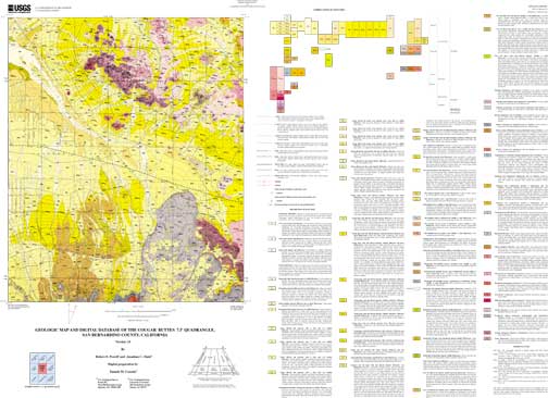
1) coug_geo - geology
Geologic units are delineated by geologic line entities and described by polygons which are attributed with the following set of attribute items in coug_geo.pat. For display purposes, the geology coverage contains three annotation subclasses: anno.geo contains unit labels, anno.fault contains formal fault names, and anno.twn_rnge contains township and range data.

COUG_GEO.PAT:

COLUMN   ITEM NAME        WIDTH OUTPUT  TYPE N.DEC  ALTERNATE NAME
    1  AREA                   8    18     F      5
    9  PERIMETER              8    18     F      5
   17  COUG_GEO#          4     5     B      -
   21  COUG_GEO-ID        4     5     B      -
   25  LABL                  35    35     C      -
   60  PLABL                 35    35     C      -
   95  TAG                   25    25     C      -
  120  SHDPS                  3     3     I      -
  123  NAME                 254   254     C      -
  377  SHDFIL                 3     3     I      -

LABL geologic map unit label, in plain text
Alphabetized list of map units symbols (LABL) and the corresponding map unit names (NAME) specified in the Cougar Buttes geologic map database (coug_geo.pat):

Jg		Granite
Jp		Porphyritic quartz monzonite, monzogranite,
			and granodiorite
Kcb		Monzogranite of Cougar Buttes
Kgd		Granodiorite
Kmi		Mafic-rich intermediate rocks
Kmp		Mixed plutonic rocks
Kp		Porphyritic monzogranite
MzPrgg		Granitic orthogneiss
Prgn		Gneiss
QTbrbc		Breccia, strata of Blackhawk Canyon
QTbrc 		Breccia, carbonate rocks
QTbrg		Breccia, granitic rocks
QTc		Conglomerate of Cushenbury Spring
QTs1		Sandstone and conglomerate, member 1
QTs2		Sandstone and conglomerate, member 2
QTspcb 		Saprolite, monzogranite of Cougar Buttes
QTspmp 		Saprolite, mixed plutonic rocks
Qmof		Moderately old alluvial fan deposits
Qmof? 		Moderately old alluvial fan deposits?
Qmol		Moderately old lacustrine deposits
Qmol? 		Moderately old lacustrine deposits?
Qmolsbc		Moderately old landslide breccia,
			strata of Blackhawk Canyon
Qmolsc		Moderately old landslide breccia,
		carbonate rocks
Qmolscc		Moderately old landslide breccia,
			conglomerate of Cushenbury Springs
Qmos		Moderately old slope wash and alluvial
			deposits
Qoc		Old colluvial deposits
Qoc?		Old colluvial deposits?
Qoc1		Old colluvial deposits, unit 1
Qoc2		Old colluvial deposits, unit 2
Qof		Old alluvial fan deposits
Qof? 		Old alluvial fan deposits?
Qolsbc		Old landslide breccia, strata of Blackhawk
		Canyon
Qolsc		Old landslide breccia, carbonate-rock
Qolsg		Old landslide breccia, granitic rocks
Qp		Active playa deposits
Qvodf		Very old debris flow fan deposits
Qvof1		Very old alluvial fan deposits, unit 1
Qvof2		Very old alluvial fan deposits, unit 2
Qvos		Very old slope wash and alluvial deposits
Qvos? 		Very old slope wash and alluvial deposits?
Qw		Active wash deposits
Qya		Young axial valley deposits
Qyas+Qye	Young alluvial and slope wash deposits +
		Quaternary young eolian deposits
Qydf		Young debris flow fan deposits
Qye		Young eolian deposits
Qye? 		Young eolian deposits?
Qyf		Young alluvial fan deposits
Qyf1		Young alluvial fan deposits, unit 1
Qyf2		Young alluvial fan deposits, unit 2
Qyf3		Young alluvial fan deposits, unit 3
Qyf4		Young alluvial fan deposits, unit 4
Qyfe		Young alluvial fan and eolian deposits
Qyfe? 		Young alluvial fan and eolian deposits?
Qyfs 		Young alluvial fan sand deposits
Qyfw1		Young alluvial fan feeder wash deposits,
			unit 1
Qyfw2		Young alluvial fan feeder wash deposits,
			unit 2
Qyfw3		Young alluvial fan feeder wash deposits,
			unit 3
Qyfw4		Young alluvial fan feeder wash deposits,
			unit 4
Qyls		Young landslide deposits
Qyos 		Young(?) and old slope wash and alluvial deposits
Qyoss1		Young(?) and old slope wash and alluvial deposits,
			substrate 1
Qyoss2		Young(?) and old slope wash and alluvial deposits,
			substrate 2
Qyoce		Young and old colluvial and eolian deposits
Qyp		Young playa deposits
Qyse		Young slope wash, alluvial, and eolian deposits
Qyse? 		Young slope wash, alluvial, and eolian deposits?
Qysos1		Young slope wash and alluvial deposits,
			oxidized, substrate 1
Qysos2		Young slope wash and alluvial deposits,
			oxidized, substrate 2
Qysos2? 		Young slope wash and alluvial deposits,
			oxidized, substrate 2?
Qysos3		Young slope wash and alluvial deposits,
			oxidized, substrate 3
Qysos3? 		Young slope wash and alluvial deposits,
			oxidized, substrate 3?
Qyss		Young slope wash and alluvial deposits,
			sandstone substrate
Qysws1		Young slope wash and alluvial deposits,
			white, substrate 1
Qysws2		Young slope wash and alluvial deposits,
			white, substrate 2
Qyw		Young wash deposits
Ta		Arkosic sandstone
Ta? 		Arkosic sandstone?
Tb		Basalt
Tl		Lacustrine strata
Tl? 		Lacustrine strata?
PLABL coded geologic map unit label used to generate plot labels with relevant stratigraphic symbols. The geologic units with LABL MzPrgg (Mesozoic or Proterozoic) and Prgn (Proterozoic) appear as }<gg, <gn respectively in the item PLABL. The replacement characters call their corresponding symbols from the Stratagem Font Group. Geologic map unit labels will plot on derivative map plots with appropriate stratigraphic symbols if PLABL is used as the source of unit labels. The Stratagem Font Group is accessed through geofont.txt, and is included in the data package.
TAG enables identification of polygons, within a unit, of which the geology is sufficiently distinct from that of the overall unit. The default designation is the unit label with the suffix A. Polygons representing unique properties other than the default can be identified with suffixes B, C...etc. All polygons in the Cougar Buttes quadrangle are designated by the suffix A.
SHDPS polygon color from shadeset scamp2.shd (included in the data package)
NAME geologic name of each unit
SHDFIL polygon fill pattern from shadeset geology2.shd (included in the data package)
Geologic lines, which include features such as faults, contacts, and marker horizons are attributed with the following set of feature attribute items contained in coug_geo.aat. (A complete description of each line type is available in the data table, lines.rel.)

COUG_GEO.AAT:

COLUMN   ITEM NAME        WIDTH OUTPUT  TYPE N.DEC  ALTERNATE NAME
    1  FNODE#                 4     5     B      -
    5  TNODE#                 4     5     B      -
    9  LPOLY#                 4     5     B      -
   13  RPOLY#                 4     5     B      -
   17  LENGTH                 8    18     F      5
   25  COUG_GEO#          4     5     B      -
   29  COUG_GEO-ID        4     5     B      -
   33  L-TAG                 25    25     C      -
   58  L-SYMB                 3     3     I      -
   61  L-NAME               200   200     C      -


L-TAG line tag which consists of a character and numerical value, e.g. C17, allows the user to relate the line entity to its corresponding definition in lines.rel
List of line types used in the Cougar Buttes geologic map coverage (coug _geo.aat), including abbreviated descriptions from lines.rel:
C17	Contact, landslide, location meets map accuracy standard
C18	Contact, landslide, location may not meet map accuracy
	standard
C2	Contact, generic, location may not meet map accuracy
	standard
C22	Contact, landslide, questionable, location may not meet map
	accuracy standard
C23	Contact, landslide, questionable, covered, location may not
	meet map accuracy standard
C30	Contact, sedimentary, location may not meet map accuracy
	standard
C31	Contact, sedimentary, inferred, location may not meet map
	accuracy standard
C32	Contact, sedimentary, covered, location may not meet map
	accuracy standard
C42	Contact, sedimentary, gradational, location may not meet
	map accuracy standard
C49	Contact, igneous, location meets map accuracy standard
C50	Contact, igneous, location may not meet map accuracy
	standard
C65	Contact, metamorphic, location meets map accuracy standard
C66	Contact, metamorphic, location may not meet map accuracy
	standard
C81	Contact, regolith, location meets map accuracy standard
C82	Contact, regolith, location may not meet map accuracy
	standard
CL1	Cartographic line, map boundary
F14	Fault, high angle, strike slip, right lateral, inferred,
	location may not meet map accuracy standard
F16	Fault, high angle, normal slip, location may not meet map
	accuracy standard
F20	Fault, high angle, strike slip, right lateral, covered,
	location may not meet map accuracy standard
F22	Fault, high angle, normal slip, covered, location may not
	meet map accuracy standard
F31	Fault, high angle, slip unspecified, generic, inferred,
	location may not meet map accuracy standard
F38	Fault, high angle, strike slip, right lateral,
	questionable, location may not meet map accuracy standard
F8	Fault, high angle, strike slip, right lateral, location
	may not meet map accuracy standard
F90	Fault, low angle, slip unspecified, older over younger,
	location may not meet map accuracy standard
F98	Fault, low angle, normal slip, younger over older,
	location may not meet map accuracy standard
MH1	Marker horizon, buried paleosol, location meets map
	accuracy standard

L-SYMB calls up the appropriate line symbol from the lineset geoscamp2.lin (included in the data package)
L-NAME formal name, where applicable, of geologic linear feature The Helendale Fault is the only formally named fault in the Cougar Buttes quadrangle.

2) coug_str - structural lines
Geologic stuctural features in the Cougar Buttes quadrangle include upright anticlines and upright synclines. The attribute values, L-TAG and L-SYMB, link the line tag to the data table, lines.rel and call up the appropriate line symbol from the lineset geoscamp2.lin respectively.

COUG_STR.AAT:

COLUMN   ITEM NAME        WIDTH OUTPUT  TYPE N.DEC  ALTERNATE NAME
    1  FNODE#                 4     5     B      -
    5  TNODE#                 4     5     B      -
    9  LPOLY#                 4     5     B      -
   13  RPOLY#                 4     5     B      -
   17  LENGTH                 8    18     F      5
   25  COUG_STR#              4     5     B      -
   29  COUG_STR-ID            4     5     B      -
   33  L-TAG                 25    25     C      -
   58  L-SYMB                 3     3     I      -


List of line types used in the Cougar Buttes structural map coverage (coug _str.aat), including abbreviated descriptions from lines.rel:
FA33	Fold axial trace, anticline, upright, location meets map
	accuracy standard
FA97	Fold axial trace, syncline, upright, location meets map
	accuracy standard


3) coug_pts - geological point data
Geological point data includes information describing the types and the orientation of bedding, foliation, and lineations. One annotation subclass is included in the geologic points coverage: dip displays the respective dip and plunge values associated with individual point data.

COUG_PTS.PAT:

COLUMN   ITEM NAME        WIDTH OUTPUT  TYPE N.DEC  ALTERNATE NAME
    1  AREA                   8    18     F      5
    9  PERIMETER              8    18     F      5
   17  COUG_PTS#              4     5     B      -
   21  COUG_PTS-ID            4     5     B      -
   25  P-DIP                  3     3     I      -
   28  P-STRIKE               3     3     I      -
   31  P-SYMB                 3     3     I      -
   34  P-TAG                 25    25     C      -
   59  P-PLUNGE               3     3     I      -
   62  P-DIPDIR               3     3     I      -


P-DIP the dip of planar features
P-STRIKE the azimuth strike of planar features
P-SYMB calls the point-type from the markerset geoscamp2.mrk (included in the data package)
P-TAG point tag which consists of a character(s) and numerical value, e.g. FN42, allows the user to relate the point entity to its corresponding definition in the data table, points.rel
Point types (quantitative orientation data) in coug_pts.pat and their corresponding, abbreviated descriptions from points.rel:


B2	Bedding attitude, sedimentary, inclined
FN42	Foliation attitude, metamorphic, inclined
L26	Lineation, metamorphic, minor fold axes, sinistral
	rotation

P-PLUNGE lineation plunge value
P-DIPDIR azimuthal direction of dip To date, there is no other way to indicate to the user the cardinal direction of dip using the traditional convention (traditional geologic notation allows a quadrant designation following the dip value).
4) coug_ptsorn - structural line ornamentation
The point data included in coug_ptsorn allow a visual representation of the type of structural linear feature, e.g. anticline and syncline symbols. The items P-TAG and P-SYMB link the point tag to its full description in points.rel and call up the appropriate point symbol from geoscamp2.mrk.

COUG_PTSORN.PAT:

COLUMN   ITEM NAME        WIDTH OUTPUT  TYPE N.DEC  ALTERNATE NAME
    1  AREA                   8    18     F      5
    9  PERIMETER              8    18     F      5
   17  COUG_PTSORN#           4     5     B      -
   21  COUG_PTSORN-ID         4     5     B      -
   25  P-TAG                 25    25     C      -
   50  P-SYMB                 3     3     I      -


Point types (fold axes ornamentation) in coug_ptsorn.pat and their corresponding, abbreviated descriptions from points.rel:


FAC10	Fold ornament, syncline, upright axial plane
FAC4	Fold ornament, anticline, upright axial plane


5) coug_ldr - annotation leaders
Annotation leaders point to unit labels that are placed outside the perimeter of a particular geologic polygon. These cartographic line entities are attributed with only a single attribute, L-SYMB, and all have the same value, 1.

COUG_LDR.AAT:

COLUMN   ITEM NAME        WIDTH OUTPUT  TYPE N.DEC  ALTERNATE NAME
    1  FNODE#                 4     5     B      -
    5  TNODE#                 4     5     B      -
    9  LPOLY#                 4     5     B      -
   13  RPOLY#                 4     5     B      -
   17  LENGTH                 8    18     F      5
   25  COUG_LDR#              4     5     B      -
   29  COUG_LDR-ID            4     5     B      -
   33  L-SYMB                 3     3     I      -


The data dictionary tables, lines.rel and points.rel each contain three items: L-TAG and P-TAG establish the links between the .aat, and the .pat to the respective data tables. The items L-DEF and P-DEF, respectively provide the coded definition for an entity. The items L-EXP and P-EXP provide a parsed explanation of the code contained in the corresponding -DEF items.
Entity_and_Attribute_Detail_Citation:
A complete description of the polygon, line, and point data coding schemes is available in U.S. Geological Survey Open-File Reports 97-859, OFR 97-860, and OFR 97-861 (full source citations follow):
Matti, J.C., Miller, F.K., Powell, R.E., Kennedy, S.A., Bunyapanasarn, T.P., Koukladas, Catherine, Hauser, R.M., and Cossette, P.M., 1997b, Geologic-point attributes for digital geologic-map databases produced by the Southern California Areal Mapping Project (SCAMP), Version 1.0: U.S.Geological Survey Open-File Report 97-859
Matti, J.C., Miller, F.K., Powell, R.E., Kennedy, S.A., and Cossette, P.M., 1997c, Geologic-polygon attributes for digital geologic-map databases produced by the Southern California Areal Mapping Project (SCAMP), Version 1.0: U.S.Geological Survey Open-File Report 97-860
Matti, J.C., Powell, R.E., Miller, F.K., Kennedy, S.A., Ruppert, K.R., Morton, G.L., and Cossette, P.M., 1997a, Geologic-line attributes for digital geologic-map databases produced by the Southern California Areal Mapping Project (SCAMP), Version 1.0: U.S.Geological Survey Open-File Report 97-861
Distribution_Information:
Distributor:
Contact_Information:
Contact_Organization_Primary:
Contact_Organization: U.S. Geological Survey
Contact_Person: Robert E. Powell
Contact_Position: Project geologist
Contact_Address:
Address_Type: mailing address
Address:
U.S. Geological Survey
Room 202
West 904 Riverside Avenue
City: Spokane
State_or_Province: WA
Postal_Code: 99201-1007
Country: USA
Contact_Voice_Telephone: 509 368-3120
Contact_Electronic_Mail_Address: rpowell@usgs.gov
Distribution_Liability:
The U.S. Geological Survey (USGS) provides these geographic data "as is. "The USGS makes no guarantee or warranty concerning the accuracy of information contained in the geographic data. The USGS further makes no warranties, either expressed or implied as to any other matter whatsoever, including, without limitation, the condition of the product, or its fitness for any particular purpose. The burden for determining fitness for use lies entirely with the user. Although these data have been processed successfully on computers at the USGS, no warranty, expressed or implied, is made by the USGS regarding the use of these data on any other system, nor does the fact of distribution constitute or imply any such warranty.
In no event shall the USGS have any liability whatsoever for payment of any consequential, incidental, indirect, special, or tort damages of any kind, including, but not limited to, any loss of profits arising out of use of or reliance on the geographic data or arising out of the delivery, installation, operation, or support by USGS.
This digital, geologic map database of the Cougar Buttes 7.5'quadrangle, 1:24,000 map-scale, and any derivative maps thereof, is not meant to be used or displayed at any scale larger than 1:24,000 (e.g., 1:12,000).
Standard_Order_Process:
Digital_Form:
Digital_Transfer_Information:
Format_Name: ARCE
Format_Version_Number: 7.x
File_Decompression_Technique: gzip -d and tar
Transfer_Size: 3.8
Digital_Transfer_Option:
Online_Option:
Computer_Contact_Information:
Network_Address:
Fees: none

Metadata_Reference_Information:
Metadata_Date: 20160205
Metadata_Contact:
Contact_Information:
Contact_Person_Primary:
Contact_Person: Peter N Schweitzer
Contact_Organization: USGS Midwest Area
Contact_Position:
Collection manager, USGS Geoscience Data Clearinghouse, http://geo-nsdi.er.usgs.gov/
Contact_Address:
Address_Type: mailing address
Address:
Mail Stop 954
12201 Sunrise Valley Dr
City: Reston
State_or_Province: VA
Postal_Code: 20192-0002
Country: USA
Contact_Voice_Telephone: 703-648-6533
Contact_Facsimile_Telephone: 703-648-6252
Contact_Electronic_Mail_Address: pschweitzer@usgs.gov
Metadata_Standard_Name: FGDC Content Standards for Digital Geospatial Metadata
Metadata_Standard_Version: FGDC-STD-001-1998
Metadata_Access_Constraints: none
Metadata_Use_Constraints: none

This page is <https://geo-nsdi.er.usgs.gov/metadata/open-file/00-175/metadata.html>
Generated by mp version 2.9.48 on Tue Jul 03 20:05:23 2018