Citation:
Citation_Information:
Originator: Harald Drewes
Originator: Robert A. Fields
Originator: Douglas M. Hirschberg
Originator: Karen S. Bolm
Publication_Date: 2002
Title:
Spatial Digital Database for the Tectonic Map of Southeast Arizona
Geospatial_Data_Presentation_Form: map
Series_Information:
Series_Name: USGS Miscellaneous Investigations Series Map
Issue_Identification: I-1109
Publication_Information:
Publication_Place: Menlo Park, California
Publisher: U.S. Geological Survey
Online_Linkage: http://pubs.usgs.gov/imap/i1109/
Description:
Abstract:
A spatial database was created for the Drewes (1980) tectonic map of southeast Arizona: this database supercedes Drewes and others (2001, ver. 1.0). The west tectonic map (Drewes, 1980) was converted to digital format by Optronics Specialty Co., Inc. and published in 2001. Staff and a contractor at the U.S. Geological Survey in Tucson, Arizona developed a digital geologic map database for the east map in 2001, made revisions to the previously released digital data for the west map (Drewes and others, 2001, ver. 1.0), merged data files for the east and west sheets, and added additional data not previously captured.
Purpose:
This digital geospatial database is one of many being created by the U.S. Geological Survey as an ongoing effort to provide geologic information in a geographic information system (GIS) for use in spatial analysis. The resulting digital geologic map database data can be queried in many ways to produce a variety of geologic maps and derivative products. This database should not be used or displayed at any scale larger than 1:125,000 (for example, 1:100,000 or 1:24,000).
Supplemental_Information:
Contractors at the U.S. Geological Survey in Spokane, Washington, completed an interim digital database, version 1.0, with line and polygon features for Sheet 2 in 2001. The database in version 2.0 contains revisions to the Sheet 2 database and additional data such as structural strike and dip, collection sample, marker bed, marker horizon and geomorphic feature data for both Sheets 1 and 2. Digital base map data files (topography, roads, towns, rivers and lakes, etc.) are not included. Since the Drewes (1980) east and west map sheets have additional data that was not included in this database, scanned images are included as a courtesy to the reader. The digital geologic map plot files (i1109_e.hp/.eps/.pdf and i1109_w.hp/.eps/.pdf) provided in the digital package are a representation of the database. These files will not print a copy of the original Drewes (1980) Tectonic Map of Southeast Arizona.
The text report (i1109.pdf) describes the map units, the methods used to convert the geologic map data into a digital format, the ArcInfo GIS file structures and relationships, and explains how to download the digital files from the U.S. Geological Survey public access World Wide Web site on the Internet.
Time_Period_of_Content:
Time_Period_Information:
Single_Date/Time:
Calendar_Date: 2002
Currentness_Reference:
Publication supercedes Harald Drewes, William N. Kelley and Steven R. Munts, (2001).
Status:
Progress: Complete
Maintenance_and_Update_Frequency: As Needed
Spatial_Domain:
Bounding_Coordinates:
West_Bounding_Coordinate: -111.32
East_Bounding_Coordinate: -109.00
North_Bounding_Coordinate: 32.26
South_Bounding_Coordinate: 31.32
Keywords:
Theme:
Theme_Keyword_Thesaurus: USGS Thesaurus
Theme_Keyword: geology
Theme_Keyword: geologic maps
Theme_Keyword: tectonic processes
Theme_Keyword: bedrock geologic units
Theme_Keyword: geologic structure
Theme_Keyword: geospatial datasets
Theme:
Theme_Keyword_Thesaurus: ISO 19115 Topic Categories
Theme_Keyword: geoscientificInformation
Place:
Place_Keyword_Thesaurus: none
Place_Keyword: Cochise County
Place_Keyword: Pima County
Place_Keyword: Santa Cruz County
Place_Keyword: Arizona
Place_Keyword: USA
Place:
Place_Keyword_Thesaurus: Augmented FIPS 10-4 and FIPS 6-4
Place_Keyword: f04019 = Pima
Place_Keyword: f04023 = Santa Cruz
Place_Keyword: f04003 = Cochise
Access_Constraints: none
Use_Constraints:
This digital database should not be used or displayed at any scale larger than 1:125,000 (for example, 1:100,000 or 1:24,000).
Any hardcopies utilizing these datasets shall clearly indicate their source. If users modify the data in any way they are obligated to describe on the hardcopy map the types of modifications they have performed. Users specifically agree not to misrepresent these datasets, nor to imply that changes they made were approved by the U.S. Geological Survey.
Point_of_Contact:
Contact_Information:
Contact_Person_Primary:
Contact_Person: Floyd Gray
Contact_Organization: U.S. Geological Survey
Contact_Position: Geologist
Contact_Address:
Address_Type: mailing and physical address
Address:
USGS Geologic Division
Dennis DeConcini Environmental & Natural Resources Bldg.
520 North Park Ave., Room 357
City: Tucson
State_or_Province: Arizona
Postal_Code: 85719-5035
Country: USA
Contact_Voice_Telephone: 520-670-5582
Contact_Facsimile_Telephone: 520-670-5571
Contact_Electronic_Mail_Address: [email protected]
Browse_Graphic:
Data_Set_Credit:
The geologic map database was initially prepared from folded paper geologic maps (Drewes, 1980) by the staff at Optronics Specialty Co., Inc. Optronics scanned the geologic map and prepared minimally attributed ArcInfo exchange-format files. William N. Kelley and Steven R. Munts (contractors) georeferenced and transformed the data for Sheets 1 and 2 and completed the editing, data model preparation and attributing of arcs and polygons for the west sheet (Sheet 2). Robert A. Fields, Douglas M. Hirschberg (contractor) and Karen S. Bolm reviewed and edited the files for both sheets and developed additional spatial and attribute data. The manuscript and digital data were reviewed by Helen Kayser (contractor) and Pamela Derkey at the USGS Spokane office.
Native_Data_Set_Environment:
SunOS, 5.6, sun4u UNIX
ARC/INFO version 7.2.1
Cross_Reference:
Citation_Information:
Originator: Drewes, Harald
Publication_Date: 1980
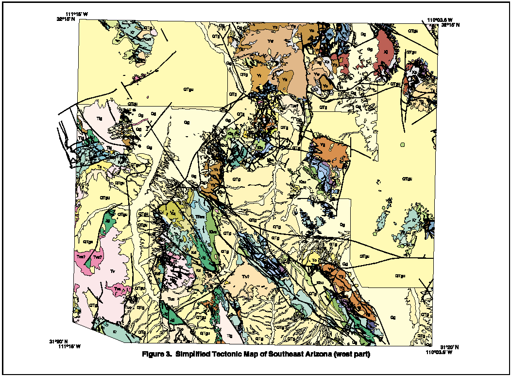
Title: Tectonic Map of Southeast Arizona
Geospatial_Data_Presentation_Form: map
Series_Information:
Series_Name: Miscellaneous Investigation Series Map
Issue_Identification: Map I-1109
Publication_Information:
Publication_Place: Denver, CO
Publisher: U.S. Geological Survey
Online_Linkage: http://pubs.usgs.gov/imap/i1109/