Digital Geologic Map of the Altiplano and Cordillera Occidental, Bolivia

Metadata also available as - [Questions & Answers] - [Parseable text] - [XML]

Metadata:

Identification_Information:
Citation:
Citation_Information:
Originator: Sherman P. Marsh
Originator: Donald H. Richter
Originator: Steve Ludington
Originator: Eduardo Soria-Escalante
Originator: Angel Escobar-Diaz
Publication_Date: 1995
Title:
Digital Geologic Map of the Altiplano and Cordillera Occidental, Bolivia
Geospatial_Data_Presentation_Form: map
Series_Information:
Series_Name: U.S. Geological Survey Open-File Report
Issue_Identification: 95-0494
Online_Linkage: http://pubs.usgs.gov/of/1995/ofr-95-0494/
Description:
Abstract:
The geologic map of the Altiplano/Cordillera Occidental was produced digitally from fifteen, 1:250,000 scale, field compilation maps. These paper maps were made by Servicio Geológico de Bolivia (GEOBOL) geologists over the last decade.
Purpose:
To provide to the public a digital geologic map database of the Altiplano and Cordillera Occidental, Bolivia
Time_Period_of_Content:
Time_Period_Information:
Single_Date/Time:
Calendar_Date: 1995
Currentness_Reference: publication date
Status:
Progress: Complete
Maintenance_and_Update_Frequency: None planned
Access_Constraints: None
Use_Constraints: None
Point_of_Contact:
Contact_Information:
Contact_Person_Primary:
Contact_Person: Richter, Donald H
Contact_Organization: USGS-GEO-WRG-MRS
Contact_Address:
Address_Type: mailing and physical address
Address: 4200 University Drive
City: Anchorage
State_or_Province: AK
Postal_Code: 99508
Country: US
Contact_Voice_Telephone: 907-786-7409
Contact_Electronic_Mail_Address: drichter@usgs.gov
Spatial_Domain:
Bounding_Coordinates:
West_Bounding_Coordinate: -69.72
East_Bounding_Coordinate: -65.98
North_Bounding_Coordinate: -16.34
South_Bounding_Coordinate: -22.90
Keywords:
Theme:
Theme_Keyword_Thesaurus: USGS Thesaurus
Theme_Keyword: geology
Theme_Keyword: geologic maps
Theme_Keyword: geologic structure
Theme_Keyword: bedrock geologic units
Theme_Keyword: geospatial datasets
Theme:
Theme_Keyword_Thesaurus: National Geologic Map Database Catalog themes, augmented
Theme_Keyword: 3100 - Vector
Theme_Keyword: 3110 - ESRI
Theme_Keyword: 3112 - export
Theme_Keyword: 1100 - Geology
Theme_Keyword: 1101 - General
Theme:
Theme_Keyword_Thesaurus: ISO 19115 Topic Categories
Theme_Keyword: geoscientificInformation
Place:
Place_Keyword_Thesaurus: Augmented FIPS 10-4 and FIPS 6-4
Place_Keyword: BL = Bolivia
Browse_Graphic:
Browse_Graphic_File_Name: Browse_Graphic_File_Description:
Reduced-size image of the geologic units and structural lines, 536x887 pixels, 56k bytes.
Browse_Graphic_File_Type: PNG
Data_Quality_Information:
Logical_Consistency_Report:
The geologic map of the Altiplano/Cordillera Occidental was produced digitally from fifteen, 1:250,000 scale, field compilation maps. These paper maps were made by Servicio Geológico de Bolivia (GEOBOL) geologists over the last decade.
Completeness_Report:
The 137 geologic units on the fifteen, 1:250,000-scale geologic maps were simplified to 15 geologic units. This simplification was based on geologic environments favorable for mineralization, on combining similar geologic terrain for plotting at the publication scale of 1:500,000, and on grouping Paleozoic sedimentary units that were mapped mostly outside the study area.
Lineage:
Source_Information:
Source_Citation:
Citation_Information:
Originator: Sherman P. Marsh
Originator: Domald H. Richter
Originator: Steve Ludington
Originator: Eduardo Soria-Escalante
Originator: Angel Escobar-Diaz
Publication_Date: 1992
Title:
Geologic map of the Altiplano and Cordillera Occidental, Bolivia
Geospatial_Data_Presentation_Form: map
Series_Information:
Series_Name: U.S. Geological Survey Bulletin
Issue_Identification: 1975
Publication_Information:
Publication_Place: Denver, CO
Publisher: U.S. Geological Survey
Other_Citation_Details: Plate 1 is the map referred to here
Larger_Work_Citation:
Citation_Information:
Originator: U.S. Geological Survey
Originator: Servicio Geologico de Bolivia
Publication_Date: 1992
Title:
Geology and Mineral Resources of the Altiplano and Cordillera Occidental, Bolivia
Geospatial_Data_Presentation_Form: map
Series_Information:
Series_Name: U.S. Geological Survey Bulletin
Issue_Identification: 1975
Publication_Information:
Publication_Place: Denver, CO
Publisher: U.S. Geological Survey
Source_Scale_Denominator: 500000
Type_of_Source_Media: paper
Source_Time_Period_of_Content:
Time_Period_Information:
Single_Date/Time:
Calendar_Date: 1992
Source_Currentness_Reference: publication date
Source_Citation_Abbreviation: Bulletin 1975, plate 1
Source_Contribution: These data were printed as plate 1 of this publication.
Process_Step:
Process_Description:
The geologic map of the Altiplano/Cordillera Occidental was produced digitally from fifteen, 1:250,000 scale, field compilation maps. These paper maps were made by Servicio Geológico de Bolivia (GEOBOL) geologists over the last decade. After examination of the field maps it was determined that the best method for capturing the geologic data digitally was by means of an optic scanner. Because of the condition of the maps and the fact that they had been hand colored the geology was transferred to mylar stable-base overlays at 1:250,000 scale using a fine (.35 mm) ink pen prior to scanning. The overlays were then scanned into ARC/INFO using a Tectronics 4991 digital drum scanner. The 15 scanned images were converted into ARC/INFO coverages and edited in ARCEDIT using all 137 geologic units derived from the original field compilation maps. The resulting 15 digital maps at 1:250,000 scale were plotted in color on an electrostatic plotter and then reviewed and edited by USGS and GEOBOL geologists using new geologic information from field studies conducted during the spring and fall of 1990.
Process_Date: 1990 - 1995
Source_Produced_Citation_Abbreviation: Bulletin 1975, plate 1
Process_Step:
Process_Description:
Data files opened and inspected; projection was implicit (parameters shown in this record were given in an aml script and appear to be appropriate) and unit symbol numbers were not associated with the map symbols or unit descriptions. These associations were adduced by inspection of the printed map and the data; spatial reference and attribute information were added to this record.
Process_Date: 20020426
Process_Contact:
Contact_Information:
Contact_Person_Primary:
Contact_Person: Peter N Schweitzer
Contact_Organization: U.S. Geological Survey, ER
Contact_Position: Geologist
Contact_Address:
Address_Type: mailing address
Address:
Mail Stop 954
12201 Sunrise Valley Drive
City: Reston
State_or_Province: VA
Postal_Code: 20192
Country: USA
Contact_Voice_Telephone: 703-648-6533
Contact_Facsimile_Telephone: 703-648-6252
Contact_Electronic_Mail_Address: pschweitzer@usgs.gov
Process_Step:
Process_Description: Creation of original metadata record
Process_Date: 20070803
Process_Contact:
Contact_Information:
Contact_Person_Primary:
Contact_Person: Peter N Schweitzer
Contact_Organization: U.S. Geological Survey, ER
Contact_Position: Geologist
Contact_Address:
Address_Type: mailing address
Address:
Mail Stop 954
12201 Sunrise Valley Drive
City: Reston
State_or_Province: VA
Postal_Code: 20192
Country: USA
Contact_Voice_Telephone: 703-648-6533
Contact_Facsimile_Telephone: 703-648-6252
Contact_Electronic_Mail_Address: pschweitzer@usgs.gov
Spatial_Data_Organization_Information:
Direct_Spatial_Reference_Method: vector
Point_and_Vector_Object_Information:
SDTS_Terms_Description:
SDTS_Point_and_Vector_Object_Type: GT-Polygon composed of chains
Point_and_Vector_Object_Count: 2000
Spatial_Reference_Information:
Horizontal_Coordinate_System_Definition:
Planar:
Map_Projection:
Map_Projection_Name: Lambert Conformal Conic
Lambert_Conformal_Conic:
Standard_Parallel: -17.333333
Standard_Parallel: -22.666667
Longitude_of_Central_Meridian: -67.5
Latitude_of_Projection_Origin: -24
False_Easting: 0
False_Northing: 0
Geodetic_Model:
Horizontal_Datum_Name: D_International_1924
Ellipsoid_Name: International_1924
Semi-major_Axis: 6378388.0
Denominator_of_Flattening_Ratio: 297.0
Entity_and_Attribute_Information:
Detailed_Description:
Entity_Type:
Entity_Type_Label: ALTIDIS.PAT
Entity_Type_Definition: Geologic map unit
Attribute:
Attribute_Label: GEO1
Attribute_Definition: Numerical value corresponding to geologic map units
Attribute_Domain_Values:
Enumerated_Domain:
Enumerated_Domain_Value: 10
Enumerated_Domain_Value_Definition:
Qsu: Surficial deposits, undifferentiated (Holocene and Pleistocene)
Includes unconsolidated alluvial, eolian, colluvial, and glacial deposits. Locally may include lacustrine and salt deposits that are not shown separately.
Attribute_Domain_Values:
Enumerated_Domain:
Enumerated_Domain_Value: 20
Enumerated_Domain_Value_Definition:
QTev: Stratovolcano deposits (Holocene to Miocene)
Lava flows, flow breccias, lahars, and minor pyroclastic deposits chiefly of andesitic to dacitic composition. May include domes and shallow intrusive bodies mostly in vent complexes. Includes deposits mapped as Cerkhe Formation, Estratovolcano Formation, and Huaricunca Formation.
Attribute_Domain_Values:
Enumerated_Domain:
Enumerated_Domain_Value: 30
Enumerated_Domain_Value_Definition:
Ql: Lacustrine deposits (Holocene and Pleistocene)
Chiefly calcareous tufa in ancient lake shorelines and lacustrine mud and silt deposits. Includes deposits mapped as Minchin Limestone.
Attribute_Domain_Values:
Enumerated_Domain:
Enumerated_Domain_Value: 50
Enumerated_Domain_Value_Definition:
Qs: Salt deposits (Holocene and Pleistocene)
Playa-lake evaporites. May include interbedded fine-grained lacustrine deposits. Locally may be seasonally covered with water.
Attribute_Domain_Values:
Enumerated_Domain:
Enumerated_Domain_Value: 60
Enumerated_Domain_Value_Definition:
QTig: Ignimbrite (Pleistocene to Miocene)
Welded and nonwelded ash-flow tuffs, chiefly in extensive outflow sheets. Mostly of dacitic composition. Sources probably large caldera complexes, only a few of which are identified. Locally, may include basinal lacustrine sediments. Includes deposits mapped as Ignimbrite Formation and Perez Tuff.
Attribute_Domain_Values:
Enumerated_Domain:
Enumerated_Domain_Value: 70
Enumerated_Domain_Value_Definition:
QTs: Sedimentary rocks (Pleistocene and Pliocene)
Nonmarine sandstone, conglomerate, and shale. May include minor interlayered volcanic rocks. Includes deposits mapped as Aroma Formation, Charaña Formation, La Paz Formation, Pomata Formation, Remedios Formation, Topohoco Formation, Taracollo Formation, Ulloma Formation, and Umala Formation.
Attribute_Domain_Values:
Enumerated_Domain:
Enumerated_Domain_Value: 100
Enumerated_Domain_Value_Definition:
Ti: Intrusive rocks (Pliocene to Oligocene)
Chiefly subvolcanic stocks, plugs, and dikes of dacitic composition in vent complex of eroded volcanic eruptive centers. Not all intrusive rocks mapped; many are included in unit of undifferentiated volcanic rocks (Tvnd). Important host rock for Bolivian polymetallic vein deposits.
Attribute_Domain_Values:
Enumerated_Domain:
Enumerated_Domain_Value: 110
Enumerated_Domain_Value_Definition:
Tvnd: Volcanic rocks, undifferentiated (Miocene and Oligocene)
Chiefly lava flows, but includes extensive pyroclastic deposits and intrusive rocks in some areas where not mapped separately as units Tig and Ti, and locally may include interbedded nonmarine sedimenatry rocks. Mostly of andesitic and dacitic composition; sources are poorly defined volcanic eruptive centers, now deeply eroded. Includes deposits mapped as Abaroa Formation, Bonete lavas, Camargo volcanic rocks, Carangas volcanic rocks, Cuzco volcanic rocks, Julaca lavas, Mauri Formation, Murmuntani Formation, Negrillos volcanic rocks, Pulacayo volcanic rocks, Rondal lavas, Tagua Formation, and Ubina volcanic rocks.
Attribute_Domain_Values:
Enumerated_Domain:
Enumerated_Domain_Value: 120
Enumerated_Domain_Value_Definition:
Tig: Pyroclastic rocks (Miocene and Oligocene)
Chiefly welded to nonwelded ash-flow tuffs, but includes air-fall tuffs and thin, volcaniclastic beds. Mostly dacitic in composition. Source same as undifferentiated volcanic rocks (Tvnd) but generally occur more distant from eruptive center. Includes deposits mapped as Upper Quehua Formation.
Attribute_Domain_Values:
Enumerated_Domain:
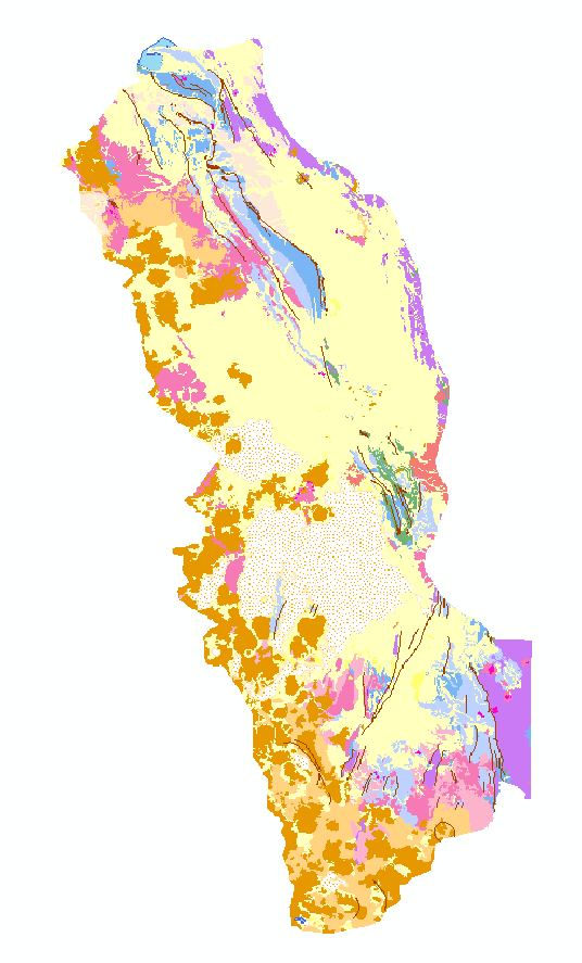
Enumerated_Domain_Value: 130
Enumerated_Domain_Value_Definition:
Ts2: Sedimentary rocks (Pliocene to Oligocene)
Nonmarine sandstone, conglomerate, shale, marl, and evaporites. Includes deposits mapped as Azurita Formation, Ballivian Formation, Coniri Formation, Cosuño Formation, Crucero Formation, Huayllamarca Formation, Huayllapucara Formation, Kasira Formation, Lower Quehua Formation, Mondragon Formation, Pizaqueri Formation, San Vicente Formation, Tambillo Formation, Totora Formation, and Turco Formation.
Attribute_Domain_Values:
Enumerated_Domain:
Enumerated_Domain_Value: 140
Enumerated_Domain_Value_Definition:
Ts1: Sedimentary rocks (Oligocene to Paleocene)
Nonmarine, mostly reddish colored conglomerate, sandstone, shale, and mudstone. Primary host for sedimentary-hosted copper deposits. Includes deposits mapped as Berenguela Formation, Nazareno Formation, Potoco Formation, Santa Lucia Formation, San Andres Formation, and Tihuanacu Formation.
Attribute_Domain_Values:
Enumerated_Domain:
Enumerated_Domain_Value: 150
Enumerated_Domain_Value_Definition:
Tmf: Los Frailes and Morococala Ignimbrites (Miocene)
Ash-flow tuffs of dacitic composition in extensive ignimbrite field exposed primarily east of map area.
Attribute_Domain_Values:
Enumerated_Domain:
Enumerated_Domain_Value: 160
Enumerated_Domain_Value_Definition:
Ks? Three polygons with this attribute value occur in the data. One is a sliver polygon, and the other two are symbolized as Ks on the printed map.
Attribute_Domain_Values:
Enumerated_Domain:
Enumerated_Domain_Value: 200
Enumerated_Domain_Value_Definition:
Ks: Sedimentary rocks (Cretaceous)
Marine and nonmarine sandstone, shale, marl, and limestone. Includes deposits mapped as Aroifilla Formation, El Molino Formation, La Puerta Formation, Miraflores Formation, and Tarapaya Formation.
Attribute_Domain_Values:
Enumerated_Domain:
Enumerated_Domain_Value: 300
Enumerated_Domain_Value_Definition:
Pzs: Sedimentary rocks (Paleozoic)
Chiefly marine sandstone and shale of Devonian to Ordovician age. Rocks are generally highly folded and locally penetratively deformed. Includes deposits mapped as Amatura Formation, Cancañiri Formation, Catavi Formation, Colpachuco Formation, Copacabana Formation, Cumana Formation, Huanuni Formation, Khasa Formation, Llallagua Formation, Sica Sica Formation, Uncia Formation, and Vila Vila Formation.
Attribute_Domain_Values:
Enumerated_Domain:
Enumerated_Domain_Value: 400
Enumerated_Domain_Value_Definition:
Tdp: Gypsum diapirs (Miocene to Eocene?)
May include halite and other evaporite minerals. Includes deposits mapped as Chuquichambi Formation and Jalluma Formation.
Attribute_Domain_Values:
Enumerated_Domain:
Enumerated_Domain_Value: 1001
Enumerated_Domain_Value_Definition: Bodies of water
Distribution_Information:
Distributor:
Contact_Information:
Contact_Organization_Primary:
Contact_Organization: USGS Information Services
Contact_Address:
Address_Type: mailing
Address: Box 25286, Denver Federal Center
City: Denver
State_or_Province: Colorado
Postal_Code: 80255-0046
Country: USA
Contact_Voice_Telephone: 1-888-ASK-USGS
Contact_Facsimile_Telephone: 1-303-202-4695
Contact_Electronic_Mail_Address: infoservices@usgs.gov
Resource_Description: US Geological Survey Open File Report 95-0494
Distribution_Liability:
The database has been approved for release and publication by the Director of the USGS. Although this database has been subjected to rigorous review and is substantially complete, the USGS reserves the right to revise the data pursuant to further analysis and review. Furthermore, it is released on condition that neither the USGS nor the United States Government may be held liable for any damages resulting from its authorized or unauthorized use.
Standard_Order_Process:
Digital_Form:
Digital_Transfer_Information:
Format_Name: ARCE
Format_Information_Content:
ARC/INFO export format  Description of coverage

altidis.new.e00         ARC/INFO export file of the geologic map
labels.e00              ARC/INFO export file of labels for geologic map
struct.all.e00          ARC/INFO export file of the structural geology map
volmajor.e00            ARC/INFO export file of major volcanoes
volminor.e00            ARC/INFO export file of minor volcanoes
File_Decompression_Technique: No compression applied
Digital_Transfer_Option:
Online_Option:
Computer_Contact_Information:
Network_Address:
Fees: none
Metadata_Reference_Information:
Metadata_Date: 20160610
Metadata_Contact:
Contact_Information:
Contact_Person_Primary:
Contact_Person: Peter N Schweitzer
Contact_Organization: USGS Midwest Area
Contact_Position:
Collection manager, USGS Geoscience Data Clearinghouse, http://geo-nsdi.er.usgs.gov/
Contact_Address:
Address_Type: mailing address
Address:
Mail Stop 954
12201 Sunrise Valley Dr
City: Reston
State_or_Province: VA
Postal_Code: 20192-0002
Country: USA
Contact_Voice_Telephone: 703-648-6533
Contact_Facsimile_Telephone: 703-648-6252
Contact_Electronic_Mail_Address: pschweitzer@usgs.gov
Metadata_Standard_Name: Content for Digital Geospatial Metadata
Metadata_Standard_Version: FGDC-STD-001-1998

This page is <https://geo-nsdi.er.usgs.gov/metadata/open-file/95-494/metadata.html>
Generated by mp version 2.9.48 on Tue Jul 03 20:06:32 2018