Online Links:
| Value | Definition |
|---|---|
| f | fan |
| fp | proximal fan |
| fm | medial fan |
| fd | distal fan |
| vb | valley bottom |
| Value | Definition |
|---|---|
| Jmiu | Mafic and intermediate intrusive suite, undivided (Jurassic) |
| Jmid | Mafic and intermediate intrusive suite, dark unit (Jurassic) |
| Jpw | Granite of Pinto Wash (Late or Middle Jurassic) |
| Jsbp | Porphyritic quartz monzonite, monzogranite, and granodiorite of San Bernardino Wash (Middle Jurassic) |
| Prid | Dolomite of Iron Chief mine (Middle or Early Proterozoic) |
| Prjgg | Granite gneiss of Joshua Tree (Early Proterozoic) |
| Prjgr | Porphyritic granite of Joshua Tree (Early Proterozoic) |
| Prjmr | Metamorphosed regolith (Middle or Early Proterozoic) |
| Prpgdu | Pinto Gneiss, dark unit, undivided (Early Proterozoic) |
| Prpgl | Pinto Gneiss, leucocratic granitic orthogneiss (Early Proterozoic) |
| Prppu | Metasedimentary and (or) metamorphosed hydrothermally altered rocks of Pinkham Canyon, undivided (Early Proterozoic) |
| Prppw | Siliceous granofels of Wilson Canyon (Early Proterozoic) |
| Prpqgd | Quartzite of Pinto Mountain, dark gray unit (Middle or Early Proterozoic) |
| Prpqgl | Quartzite of Pinto Mountain, light gray unit (Middle or Early Proterozoic) |
| Prpqp | Quartzite of Pinto Mountain, pelitic unit (Middle or Early Proterozoic) |
| Prpqw | Quartzite of Pinto Mountain, white unit (Middle or Early Proterozoic) |
| Prpq1 | Quartzite of Pinto Mountain, Unit 1 (Middle or Early Proterozoic) |
| Prpq2 | Quartzite of Pinto Mountain, Unit 2 (Middle or Early Proterozoic) |
| Prpq3 | Quartzite of Pinto Mountain, Unit 3 (Middle or Early Proterozoic) |
| Prpq4 | Quartzite of Pinto Mountain, Unit 4 (Middle or Early Proterozoic) |
| Prpq5 | Quartzite of Pinto Mountain, Unit 5 (Middle or Early Proterozoic) |
| Prpq6 | Quartzite of Pinto Mountain, Unit 6 (Middle or Early Proterozoic) |
| Prpq7 | Quartzite of Pinto Mountain, Unit 7 (Middle or Early Proterozoic) |
| Prpq8 | Quartzite of Pinto Mountain, Unit 8 (Middle or Early Proterozoic) |
| Prpq9 | Quartzite of Pinto Mountain, Unit 9 (Middle or Early Proterozoic) |
| QTcq | Conglomerate, quartzite-clast (Quarternary and (or) Tertiary) |
| QTpbc | Sedimentary strata of Pinto Basin, conglomerate beds (Pleistocene and (or) Pliocene) |
| QTpbd | Sedimentary strata of Pinto Basin, debris flow deposits (Pleistocene and (or) Pliocene) |
| QTpbl | Sedimentary strata of Pinto Basin, lacustrine beds (Pleistocene and (or) Pliocene) |
| QTpbs | Sedimentary strata of Pinto Basin, sandstone beds (Pleistocene and (or) Pliocene) |
| QTsu | Sedimentary deposits, undivided (Quaternary and (or) Tertiary) |
| Qcu | Colluvial deposits, undivided (Quaternary) |
| Qoam1 | Old alluvial deposits, middle unit 1 (middle and early Pleistocene) |
| Qoam2 | Old alluvial deposits, middle unit 2 (middle? Pleistocene) |
| Qoam3 | Old alluvial deposits, middle unit 3 (late Pleistocene) |
| Qoamu | Old alluvial deposits, middle unit, undivided (Pleistocene) |
| Qoay | Old alluvial deposits, young unit (Holocene? and late Pleistocene) |
| Qoc1 | Old colluvial deposits, Unit 1 (Pleistocene) |
| Qoc2 | Old colluvial deposits, Unit 2 (Pleistocene) |
| Qocu | Old colluvial deposits, undivided (Pleistocene) |
| Qvoa | Very old alluvial deposits (early Pleistocene) |
| Qvya1 | Very young alluvial deposits, Unit 1 (late Holocene) |
| Qvya2 | Very young alluvial deposits, Unit 2 (late Holocene) |
| Qvyau | Very young alluvial deposits, undivided (late Holocene) |
| Qyamg1 | Young alluvial deposits, middle unit, gravelly facies 1 (middle Holocene) |
| Qyamg2 | Young alluvial deposits, middle unit, gravelly facies 2 (middle Holocene) |
| Qyamgu | Young alluvial deposits, middle unit, gravelly facies, undivided (middle Holocene) |
| Qyams | Young alluvial deposits, middle unit, sandy facies (middle Holocene) |
| Qyamu | Young alluvial deposits, middle unit, undivided (middle Holocene) |
| Qyaog1 | Young alluvial deposits, old unit, gravelly facies 1 (middle and (or) early Holocene) |
| Qyaog1r | Young alluvial deposits, old gravelly facies 1, rough surface (middle and (or) early Holocene) |
| Qyaog2 | Young alluvial deposits, old gravelly facies 2 (middle and (or) early Holocene) |
| Qyaog2r | Young alluvial deposits, old gravelly facies 2, rough surface (middle and (or) early Holocene) |
| Qyaogu | Young alluvial deposits, old gravelly facies, undivided (middle and (or) early Holocene) |
| Qyaos | Young alluvial deposits, old oxidized sandy unit (middle and (or) early Holocene and late Pleistocene?) |
| Qyau | Young alluvial deposits, undivided (Holocene) |
| Qyass | Young alluvial sand-skirt deposits (Holocene) |
| Qyayg | Young alluvial deposits, young gravelly facies (late and (or) middle Holocene) |
| Qyays | Young alluvial deposits, young sandy facies (late and (or) middle Holocene) |
| Qyayu | Young alluvial deposits, young unit, undivided (late and (or) middle Holocene) |
| Qvyye | Very young and (or) young eolian deposits (Holocene) |
| Qvyyp | Very young and (or) young playa deposits (Holocene) |
| Ts | Sedimentary deposits (late? and middle Miocene) |
| Tb | Basalt (late and middle Miocene) |
| TJdu | Dike rocks, undivided (Tertiary, Cretaceous, and (or) Jurassic) |
| TJh | Hypabyssal intrusive rocks (Tertiary, Cretaceous, or Jurassic) |
| Value | Definition |
|---|---|
| Jmi | Mafic and intermediate intrusive suite |
| Jsb | Quartz monzonite, monzogranite, and granodiorite of San Bernardino Wash (Middle Jurassic) |
| Prjg | Porphyritic granite and granite gneiss of Joshua Tree (Early Proterozoic) |
| Prpp | Metasedimentary and (or) metamorphosed hydrothermally altered rocks of Pinkham Canyon (Early Proterozoic) |
| Prpqg | Quartzite of Pinto Mountain, gray unit (Middle or Early Proterozoic) |
| Prpq1-4 | Quartzite of Pinto Mountain, Units 1 to 4, undivided (Middle or Early Proterozoic) |
| Value | Definition |
|---|---|
| Prpgd | Pinto Gneiss, dark unit (Early Proterozoic) |
| Prpq | Quartzite of Pinto Mountain (Middle or Early Proterozoic) |
| Value | Definition |
|---|---|
| Prems | Metasedimentary rocks of Eagle Mountains assemblage (Middle or Early Proterozoic) |
| Prpg | Pinto Gneiss of Miller, 1938 (Early Proterozoic) |
| Value | Definition |
|---|---|
| Pre | Eagle Mountains assemblage (Proterozoic) |
| Prhga | Gneiss assemblage of Hexie Mountains (Early Proterozoic) |
| Value | Definition |
|---|---|
| Qyamg | Young alluvial deposits, middle gravelly facies (Holocene) |
| Qyaog | Young alluvial deposits, old gravelly facies (Holocene) |
| Value | Definition |
|---|---|
| Qoam | Old alluvial deposits, middle unit (Pleistocene) |
| Qyam | Young alluvial deposits, middle unit (middle Holocene) |
| Qyao | Young alluvial deposits, old unit (middle and early Holocene) |
| Qyay | Young alluvial deposits, young unit (late and middle Holocene) |
| Value | Definition |
|---|---|
| Qoa | Old alluvial deposits (Holocene? and Pleistocene) |
| Qvya | Very young alluvial deposits (late Holocene) |
| Qya | Young alluvial deposits (Holocene) |
| Qoc | Old colluvial deposits (Pleistocene) |
| Value | Definition |
|---|---|
| Qovoa | Old and very old alluvial deposits (Pleistocene) |
| Qvyya | Very young and young alluvial deposits (Holocene) |
| Value | Definition |
|---|---|
| Qa | Alluvial deposits (Quaternary) |
| Qc | Colluvial deposits (Quaternary) |
| QTa | Alluvial deposits (Quaternary and (or) Tertiary) |
| Value | Definition |
|---|---|
| QTpb | Sedimentary strata of Pinto Basin (Pleistocene and (or) Pliocene) |
| Value | Definition |
|---|---|
| QTs | Sedimentary deposits (Pleistocene and (or) Pliocene) |
| Value | Definition |
|---|---|
| Qvyye | Discontinuous Qvyye veneer on mapped unit |
| Qocu | Discontinuous Qocu veneer on mapped unit |
| Qyams | Continuous Qyams veneer on underlying Qyaos unit |
| Qocu, Qvyye | Discontinuous Qvyye and Qocu veneers on mapped unit |
| Value | Definition |
|---|---|
| Qocu, Qvyye | Discontinuous Qvyye and Qocu veneers on mapped underlying unit |
| Value | Definition |
|---|---|
| questionable | Identity of unit is attributed as questionable where unit assignment based on interpretation of aerial photographs is uncertain. |
| Value | Definition |
|---|---|
| cartographic, map boundary | The map boundary forms part of the perimeter of polygons that occur along the margins of the map. |
| contact | Boundary between two rock units; formed as fault, intrusive border, bedding plane, or unconformity |
| facies boundary | Intra-unit lithologic boundary between coeval deposits derived either from different source terranes or from different drainage basins in the same source terrane |
| fault-line scarp | Steep slope formed by differential erosion along a fault line |
| Value | Definition |
|---|---|
| fault | Surface or zone of surfaces separating two bodies of rock and across which one body has slid past the other |
| Value | Definition |
|---|---|
| TJdu | Dike, undivided (Tertiary, Cretaceous, or Jurassic) |
Pamela Cossette prepared the digital data set.
Geologic mapping, topical studies, and digital preparation for this report were sponsored jointly by the following: (1) the National Cooperative Geologic Mapping Program of the U.S. Geological Survey, (2) California Geological Survey, and (3) the National Park Service (Joshua Tree National Park).
This database was prepared in the GIS laboratory at the Spokane Field Office of the USGS in Spokane, Washington. The facility is maintained primarily by the Mineral Resource Surveys Program and supported in part by the National Geologic Mapping Program.
Technical review by Fred K. Miller has led to significant improvements in the database and in the map plot file. Digital review by Rachel Hauser Alvarez has allowed us to further improve the digital database.
The data set for the Pinto Mountain quadrangle has been prepared by the Southern California Areal Mapping Project (SCAMP), a cooperative project sponsored jointly by the U.S. Geological Survey and the California Geological Survey. The Pinto Mountain data set represents part of an ongoing effort to create a regional GIS geologic database for southern California. This regional digital database, in turn, is being developed as a contribution to the National Geologic Map Database of the National Cooperative Geologic Mapping Program of the USGS. The Pinto Mountain database has been prepared in cooperation with the National Park Service as part of an ongoing project to provide Joshua Tree National Park with a geologic map base for use in managing Park resources and developing interpretive materials.
The digital geologic map database for the Pinto Mountain quadrangle has been created as a general-purpose data set that is applicable to land-related investigations in the earth and biological sciences. Along with geologic map databases in preparation for adjoining quadrangles, the Pinto Mountain database has been generated to further our understanding of bedrock and surficial processes at work in the region and to document evidence for seismotectonic activity in the eastern Transverse Ranges. The database is designed to serve as a base layer suitable for ecosystem and mineral resource assessment and for building a hydrogeologic framework for the Pinto Basin.
Online Links:
Online Links:
Are there legal restrictions on access or use of the data?Access_Constraints: None
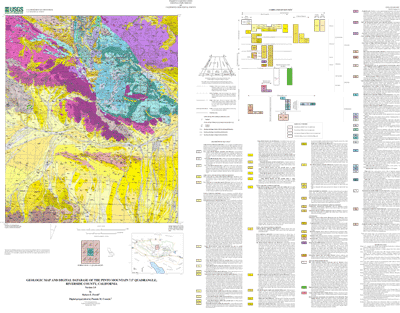
Use_Constraints:Spatial Resolution. Use of this digital geologic map should not violate the spatial resolution of the data. The Pinto Mountain geologic map and database was developed using digital orthophotograph quarter quadrangles (DOQQs) as a base. DOQQs have a pixel resolution of 1 m and are accurate to a scale of 1:12,000 (1 in = 1,000 ft). Any enlargement beyond 1:12,000 exceeds the spatial resolution of the geologic data and should not be used in lieu of a more detailed site-specific geologic evaluation. Similarly, the digital topographic base map is derived from the U.S. Geological Survey, 1:24,000-scale Pinto Mountain 7.5 minute quadrangle (provisional edition, 1986); any enlargement beyond 1:24,000 exceeds the spatial resolution of the topographic data. Plotting or viewing of the data at scales larger than 1:12,000 on the DOQQ base, or larger than 1:24,000 on the topographic base, will not yield greater real detail, although it may reveal fine-scale irregularities below the intended resolution of the database. Where the geologic data is used in combination with the topographic data, the resolution of the combined output is limited by the lower resolution of the topographic data. Where this database is used in combination with other data of higher resolution, the resolution of the combined output will be limited by the lower resolution of these data.
Content. This database, identified as "Geologic map and digital database of the Pinto Mountain 7.5 minute quadrangle, Riverside County, California" has been approved for release and publication by the Director of the U.S. Geological Survey. Although this database has been subjected to rigorous review and is substantially complete, the USGS reserves the right to revise the data pursuant to further analysis and review. Furthermore, it is released on the condition that neither the USGS nor the United States Government may be held responsible for any damages resulting from its authorized or unauthorized use. This database is preliminary and has not been reviewed for conformity with U.S. Geological Survey editorial standards or with the North American Stratigraphic Code. Any use of trade, product, or firm names is for descriptive purposes only and does not imply endorsement by the U.S. Government.
Faults. The Pinto Mountain database is sufficiently detailed to identify and characterize many actual and potential geologic hazards represented by faults, but it is not sufficiently detailed for site-specific determinations or evaluations of these features. Faults shown do not take the place of fault-rupture hazard zones designated by the California State Geologist (see, for example, Hart, 1988; Hart and Bryant, 1997).
Hart, E. W., 1988, Fault-rupture zones in California; Alquist-Priolo Special Studies Zones Act of 1972 with index to special studies zones maps (revised, 1988): California Division of Mines and Geology Special Publication 42.
Hart, E. W., and Bryant, W.A., 1997, Fault-rupture zones in California; Alquist-Priolo Special Studies Zones Act of 1972 with index to special studies zones maps (revised, 1997): California Division of Mines and Geology Special Publication 42.
The U.S. Geological Survey (USGS) provides these geographic data "as is." The USGS makes no guarantee or warranty concerning the accuracy of information contained in the geographic data. The USGS further makes no warranties, either expressed or implied as to any other matter whatsoever, including, without limitation, the condition of the product, or its fitness for any particular purpose. The burden for determining fitness for use lies entirely with the user. Although these data have been processed successfully on computers at the USGS, no warranty, expressed or implied, is made by the USGS regarding the use of these data on any other system, nor does the fact of distribution constitute or imply any such warranty.
In no event shall the USGS have any liability whatsoever for payment of any consequential, incidental, indirect, special, or tort damages of any kind, including, but not limited to, any loss of profits arising out of use of or reliance on the geographic data or arising out of delivery, installation, operation, or support by USGS.
This digital, geologic map database of the Pinto Mountain 7.5'quadrangle, and any derivative maps thereof, is not meant to be used or displayed at any map scale larger than 1:12,000 on the DOQQ base or 1:24,000 on the topograhic base.
| Data format: | Geologic units and structural features in format ARCE (version 8.x) Size: 7.1 |
|---|---|
| Network links: |
http://pubs.usgs.gov/of/2002/0491/pmtn.tar.gz |