Digital Version of 'Open-File Report 92-179: Geologic Map of the Cow Cove Quadrangle, San Bernardino County, California'

Metadata also available as - [Outline] - [Parseable text] - [XML]

Frequently anticipated questions:


What does this data set describe?

Title:
Digital Version of 'Open-File Report 92-179: Geologic Map of the Cow Cove Quadrangle, San Bernardino County, California'
Abstract:
This is a digital map database version of a previous U.S. Geological Survey Open-File Report, OF92-179. It contains 3 Arc/Info formatted coverages, distributed in Arc Interchange format, a plottable map representation of the database at 1:24,000 scale in Postscript and Adobe PDF formats, and the original map explanation pamphlet in text, Postscript, and Adobe PDF formats.
  1. How might this data set be cited?
    Howard G. Wilshire (author), David R. Bedford (digital compiler), and Teresa Coleman (digital compiler), 2002, Digital Version of 'Open-File Report 92-179: Geologic Map of the Cow Cove Quadrangle, San Bernardino County, California': U.S. Geological Survey Open-File Report 02-274, U.S. Geological Survey, Menlo Park, California.

    Online Links:

  2. What geographic area does the data set cover?
    West_Bounding_Coordinate: -115.752757
    East_Bounding_Coordinate: -115.623715
    North_Bounding_Coordinate: 35.376340
    South_Bounding_Coordinate: 35.248630
  3. What does it look like?
    http://pubs.usgs.gov/of/2002/0274/images/cowc-browse.jpg (JPEG)
    Reduced-size image of the map sheet, 432x628 pixels, 76k bytes
  4. Does the data set describe conditions during a particular time period?
    Calendar_Date: 1992
    Currentness_Reference:
    Publication date of original report
  5. What is the general form of this data set?
    Geospatial_Data_Presentation_Form: vector digital data
  6. How does the data set represent geographic features?
    1. How are geographic features stored in the data set?
      This is a Vector data set. It contains the following vector data types (SDTS terminology):
      • Complete chain (1000)
      • Label point (278)
      • GT-polygon composed of chains (278)
      • Point (30)
      • Label point (17)
    2. What coordinate system is used to represent geographic features?
      Grid_Coordinate_System_Name: Universal Transverse Mercator
      Universal_Transverse_Mercator:
      UTM_Zone_Number: 11
      Transverse_Mercator:
      Scale_Factor_at_Central_Meridian: 0.9996
      Longitude_of_Central_Meridian: -117.0
      Latitude_of_Projection_Origin: 0.0
      False_Easting: 500000.0
      False_Northing: 0.0
      Planar coordinates are encoded using coordinate pair
      Abscissae (x-coordinates) are specified to the nearest 0.000008
      Ordinates (y-coordinates) are specified to the nearest 0.000008
      Planar coordinates are specified in meters
      The horizontal datum used is North American Datum of 1983.
      The ellipsoid used is Geodetic Reference System 80.
      The semi-major axis of the ellipsoid used is 6378137.0.
      The flattening of the ellipsoid used is 1/298.257222.
  7. How does the data set describe geographic features?
    cowc-geo.aat
    Arcs of geologic significance
    LTYPE
    Description of the type of geologic line
    ValueDefinition
    contact, certainBoundary between two mapped units that was observed, the location of which is well known and is described in Positional_Accuracy
    crest of crater in cinder conecrest of crater in cinder cone
    dikedike
    dike, Kapa dike composed of map unit Kap
    dike, Kma dike composed of map unit Km
    dike, Kta dike composed of map unit Kt
    dike, QTbidike composed of map unit QTbi
    dike, QTsdike composed of map unit QTs
    dike?dike, assumed from map pattern
    fault, approx. locatedStructural boundary between mapped units or structural discontinuity within a mapped unit that has experienced relative offset. The existence is inferred from structural, stratographic, of lineament relations. Locational accuracy is approximate
    fault, certainStructural boundary between mapped units or structural discontinuity within a mapped unit that has experienced relative offset. Locational accuracy is well located
    fault, concealedStructural boundary between mapped units or structural discontinuity within a mapped unit that has experienced relative offset. The fault is obscured by overlying map units, so it is not well-located
    map boundaryEdge of mapped area, used to bound polygons at the edge of the map database
    cowc-geo.pat
    Geologic units
    PTYPE
    Geologic map unit symbol
    ValueDefinition
    QcpPlaya deposits in volcanic craters (Holocene)
    Q4Unit 4 (Holocene)--Alluvial fill of active channels
    Q3Unit 3 (Holocene to Pleistocene)--Undissected to little dissected alluvial deposits of unstratified to weakly stratified sand and gravel.
    Q3bSubunit 3b-Little dissected deposits about 1 to 2 m above active channels.
    Q3aSubunit 3a--Little dissected deposits 1 to 3 m above active channels.
    Q2Unit 2 (Pleistocene)--Moderately to well dissected alluvial deposits of sand and gravel.
    Q2cSubunit 2c-Moderately dissected alluvial deposits about 1 to 5 m above adjacent drainages.
    Q2bSubunit 2b-Moderately dissected alluvial deposits about 2 to 6 m above adjacent drainages.
    Q2aSubunit 2a-Generally well-dissected alluvial deposits 5 to 10 m above adjacent drainages, or 1 to 5 m above adjacent Q2b deposits.
    QTtaTalus and colluvial deposits derived from cinder cones and basalt flows (Holocene to early Pliocene)
    QT1Unit 1 (Pleistocene to Pliocene)--Dissected deposits with no relic pavement, 5 to 10 m above adjacent drainages.
    QTsConglomerate and arkosic sandstone (Quaternary or Pliocene?)
    QTlLake deposits of Valley Wells basin (Pleistocene to Pliocene)
    QTaCoarse ash and lapilli tuff (Pleistocene)
    QTtDeposits of red oxidized scoria and black unoxidized scoria consisting of pebble to cobble size fragments
    QTtbDeposits of blocks and bombs, consisting of boulder-size fragments as much as 5 m in diameter.
    QTpbPyroclastic breccia (Pleistocene to late Pliocene)
    QTfLava flow (Pleistocene to late Pliocene)
    QTtcTuffaceous breccia (Pleistocene to late Miocene)
    TtTephra (early Pliocene to late Miocene)
    TpbPyroclastic breccia (early Pliocene to late Miocene)
    TfLava flow (early Pliocene to late Miocene)
    TaVolcanic rocks (middle Miocene)
    TpPeach Springs Tuff of Young and Brennan (1974) (early Miocene)
    TsSedimentary rocks-Fine-grained sandstone, siltstone, shale, fresh water limestone locally present near base of deposits.
    TsbSedimentary rocks
    PD1Limestone (Permian to Devonian)
    CZsSiliciclastic rocks (Cambrian and Late Proterozoic)
    QTbiBasalt dikes and plugs (Holocene? to late Miocene)
    TKptPseudotachylite (Tertiary? or Cretaceous?)
    TKrRhyolitic dikes (Tertiary? or Cretaceous?)
    TKmMafic dikes (Tertiary? or Cretaceous?)
    KmMafic and intermediate dikes (Cretaceous)
    KapAplite, pegmatite, and fine- to medium-grained biotite monzogranite dikes (Cretaceous)
    KtFelsic members of Teutonia batholith
    KtiIntermediate members of Teutonia batholith
    KtmMafic member of Teutonia batholith
    ZyaAlaskite dike (Late Proterozoic? or Middle Proterozoic?)
    X2Mafic gneiss
    X1Felsic gneiss
    XuUndivided mafic and felsic gneiss
    cowc-smp.pat
    Samples
    pttype
    Description of the type of sample
    ValueDefinition
    SampleSample for K/Ar analysis
    sampno
    The sample number or designator, as depicted on the map and report Identifier without further scientific significance
    cowc-str.pat
    Structural measurment
    PTTYPE
    Description of the structural measurement (Source: This Publication)
    ValueDefinition
    beddingstratigraphic bedding
    foliationfoliation
    vert foliation and beddingvertical foliation
    Dip
    The dip value of the structural measurement
    Range of values
    Minimum:0
    Maximum:90
    Units:degrees
    Strike
    The strike of the structural measurement, based on the 'right hand rule'
    Range of values
    Minimum:0
    Maximum:360
    Units:degrees, based on the 'right-hand-rule'
    Entity_and_Attribute_Overview:
    From their origin in ArcInfo and the Alacarte package, each coverage contains topological and bookkeeping attributes of little or no scientific interest; only the attributes of scientific significance are described in detail here. The other attributes are AREA, PERIMETER, LENGTH, FNODE#, TNODE#, LPOLY#, RPOLY#, cover#, cover-ID, SEL, and SYMB.
    The primary layer is the geology layer (cowc-geo), which consists of both polygon features and arc features that describes map units (polygons), and depositional contacts, faults (which may or may not be polygon bounding features) and map boundaries.
    Map units (polygons) are described in the polygon attribute table (gran-geo.pat). The identities of the map units are recorded in the PTYPE field by map label (i.e. Ts). For a description of the map units, consult the PostScript or PDF explanation pamphlets in this report.
    Geologic lines (arcs) are recorded as strings of vectors and are described in the arc attribute table (gran-geo.aat). They define the boundaries of the map units, the faults, and the map boundaries. These distinctions, including the geologic identities of the unit boundaries, are recorded in the LTYPE field. Attributes for geologic lines generally follow a scheme of the type of geologic line (i.e. fault), followed by a locational and/or scientific modifier (i.e. approx. located or queried).
    The geologic structure layer (gran-str) consists of point features that describe geologic structures such as strike and dip of beds. Point features, typically structural measurements, are described in the point attribute table (gran- str.pat) and are used to represent locations of structural measurements such as strike and dip, and foliation. The type of structural measurement of points is attributed in the PTTYPE field, and the measurements taken at that location are attributed in the STRIKE and DIP fields.
    Features representing location of samples (gran-smp) discussed in the original report, are described in the point attribute table (cowc-smp.pat). Attributes of features in this dataset are recorded in the PTTYPE field, and the sample number from the map is recorded in the SAMPNO field.
    Entity_and_Attribute_Detail_Citation: http://pubs.usgs.gov/of/2002/0274/pdf/of02-274_1a.pdf

Who produced the data set?

  1. Who are the originators of the data set? (may include formal authors, digital compilers, and editors)
    • Howard G. Wilshire (author)
    • David R. Bedford (digital compiler)
    • Teresa Coleman (digital compiler)
  2. Who also contributed to the data set?
  3. To whom should users address questions about the data?
    David Bedford
    U.S. Geological Survey
    Geologist
    345 Middlefield Rd, MS 975
    Menlo Park, CA
    USA

    650-329-4924 (voice)
    650-329-4936 (FAX)
    dbedford@usgs.gov

Why was the data set created?

The purpose of this dataset is to archive previous geologic mapping in the area and to enable the further use, reclassification, and analysis of existing geologic map data in the area.

How was the data set created?

  1. From what previous works were the data drawn?
    USGS OFR 92-179 (source 1 of 1)
    Wilshire, H.G., 1992, Geologic Map of the Cow Cove Quandrangle, San Bernardino County, California: U.S. Geological Survey Open-File Report 92-179, U.S. Geological Survey, Menlo Park, California.

    Type_of_Source_Media: paper
    Source_Scale_Denominator: 24000
    Source_Contribution: Original mapping and description
  2. How were the data generated, processed, and modified?
    (process 1 of 2)
    Original map was scanned at a resolution of 600 dpi, vecrorized and edited in Arc/Info, transformed into UTM coordinates, and attributed according to the original publication
    Date: 19-Mar-2001 (process 2 of 2)
    Creation of original metadata record Person who carried out this activity:
    U.S. Geological Survey
    Attn: David R Bedford
    Geologist
    345 Middlefield Rd, MS975
    Menlo Park, California
    USA

    650-329-4924 (voice)
    650-329-4936 (FAX)
    dbedford@usgs.gov
  3. What similar or related data should the user be aware of?

How reliable are the data; what problems remain in the data set?

  1. How well have the observations been checked?
    Map units, geologic line types, dip values, and other attribute data were appended with a '?' if the feature was not labeled, or clearly labeled, on the original map. Dip values in the ' dip' field of the structural geology points layer that were not clearly identifiable were calculated as the NEGATIVE assumed value, and annotation values were appended with a '?' (such as if it is assumed that a dip was 37, but was not clear, -37 was entered into the dababase, and annotation of 37? was created). For instances where the dip value was absent or completely indeterminate, the value '99' was used, and no anotation was created.
    No positional accuracy information was prescribed to geologic contacts in the original report (such as approximate, concealed, etc), and thus all geologic contacts were attributed as well placed (certain, or solid lines) although the original nature of the contact is unknown.
  2. How accurate are the geographic locations?
    Point, line, and polygon features were vectorized from scans of the original maps and were edited to represent the original map at a scale of 1:24,000. This includes removing unnecessary lines, and closing all polygons. All vector geometries were then transformed into UTM coordinates with an RMS error of .003 or less.
    No positional accuracy information was prescribed to geologic contacts in the original report (such as approximate, concealed, etc), and thus all geologic contacts were attributed as well placed (certain, or solid lines) although the original nature of the contact is unknown.
  3. How accurate are the heights or depths?
  4. Where are the gaps in the data? What is missing?
    This report is intended to completely represent and describe the original publication of the surficial and bedrock materials of the map area at a scale of 1:24000.
  5. How consistent are the relationships among the observations, including topology?
    Geologic lines attributed as a 'contact' do not separate geologic map units of the same type, and are not considered as 'dangles'. All geologic polygons are attributed with map unit designators found in the original report.

How can someone get a copy of the data set?

Are there legal restrictions on access or use of the data?
Access_Constraints: None
Use_Constraints:
Acknowledgement of the U.S. Geological Survey; Uses of this digital geologic map should not violate the spatial resolution of the data. Although the digital form of the data removes the constraint imposed by the scale of a paper map, the detail and accuracy inherent in map scale are also present in the digital data. The fact that this database was edited at a scale of 1:24,000 means that higher resolution information is not present in the dataset. Plotting at scales larger than 1:24,000 will not yield greater real detail, although it may reveal fine-scale irregularities below the intended resolution of the database. Similarly, where this database is used in combination with other data of higher resolution, the resolution of the combined output will be limited by the lower resolution of these data.
  1. Who distributes the data set? (Distributor 1 of 1)
    U.S. Geological Survey
    Attn: Cow Cove, California Database
    Database coordinator
    345 Middlefield Road, MS 975
    Menlo Park, California
    USA

    (650) 329-4924 (voice)
  2. What's the catalog number I need to order this data set? USGS Open-File Report 02-274
  3. What legal disclaimers am I supposed to read?
    This report is preliminary and has not been reviewed for conformity with U.S. Geological Survey editorial standards or with the North American Stratigraphic Code. Any use of trade, product, or firm names is for descriptive purposes only and does not imply endorsement by the U.S. Government.
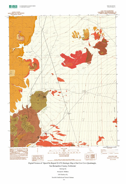
    This database, identified as "Digital Version of 'Open-File Report 92-179: Geologic Map of the Cow Cove Quadrangle, San Bernardino County, California'" has been approved for release and publication by the Director of the USGS. Although this database has been subjected to rigorous review and is substantially complete, the USGS reserves the right to revise the data pursuant to further analysis and review.
    Furthermore, it is released on condition that neither the USGS nor the United States Government may be held liable for any damages resulting from its authorized or unauthorized use.
  4. How can I download or order the data?

Who wrote the metadata?

Dates:
Last modified: 13-Jun-2016
Last Reviewed: 31-Jul-2003
Metadata author:
Peter N Schweitzer
USGS Midwest Area
Collection manager, USGS Geoscience Data Clearinghouse, http://geo-nsdi.er.usgs.gov/
Mail Stop 954
12201 Sunrise Valley Dr
Reston, VA
USA

703-648-6533 (voice)
703-648-6252 (FAX)
pschweitzer@usgs.gov
Metadata standard:
Content Standard for Digital Geospatial Metadata (FGDC-STD-001-1998)

This page is <https://geo-nsdi.er.usgs.gov/metadata/open-file/02-274/metadata.faq.html>
Generated by mp version 2.9.48 on Tue Jul 03 20:06:07 2018