Online Links:
| Value | Definition |
|---|---|
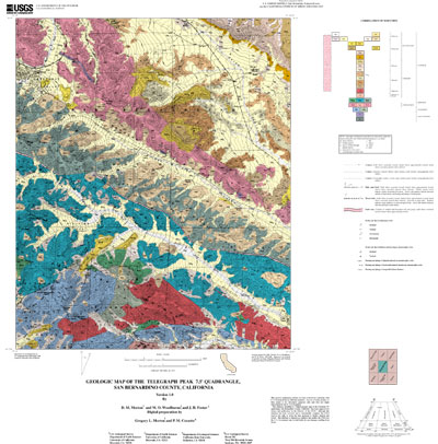
| Kcm | Tonalite of Circle Mountain |
| Kgd | Ganodiorite |
| Kss | Tonalite of San Sevaine Lookout |
| Mzpa | Pelona Schist, amphibolite grade schist |
| Mzpg | Pelona Schist, greenstone |
| Mzps | Pelona Schist, muscovite schist |
| Pzm | Metasedimentary rocks, undifferentiated |
| Pzs | Schist and gneiss |
| Qh | Harold Formation |
| Qls | Very young landslide deposits |
| Qoa | Old alluvial-valley deposits |
| Qofb | Old alluvial-fan deposits, boulder gravel |
| Qofg | Old alluvial-fan deposits, gravel |
| Qsh | Shoemaker Gravel |
| Qvof | Very old alluvial-fan deposits |
| Qvofg | Very old alluvial-fan deposits, gravel |
| Qvols | Very old landslide deposits |
| Qvolsa | Very old landslide deposits, arenaceous |
| Qwb | Very young wash deposits, boulder gravel |
| Qwg | Very young wash deposits, gravel |
| Qyfg | Young alluvial-fan deposits, gravel |
| Qyfgb | Young alluvial-fan deposits, gravel boulder |
| Qyls | Young landslide deposits |
| Qyt | Young talus deposits |
| Qywg | Young wash deposits, gravel |
| Tcv1 | Rocks of Cajon Valley, Unit 1 |
| Tcv2 | Rocks of Cajon Valley, Unit 2 |
| Tcv3 | Rocks of Cajon Valley, Unit 3 |
| Tcv5 | Rocks of Cajon Valley, Unit 5 |
| Tcv5a | Rocks of Cajon Valley, Unit 5a |
| Tpp1 | Phelan Peak deposits of Weldon (1984), Unit 1 |
| Tpp2 | Phelan Peak deposits of Weldon (1984), Unit 2 |
| Tpp3 | Phelan Peak deposits of Weldon (1984), Unit 3 |
| Ttp | Granodiorite of Telegraph Peak |
| Tv | Vaqueros Formation |
| fz | Crushed rock in fault zones |
| gn | Gneiss |
| m | Marble |
| Value | Definition |
|---|---|
| C1 | Contact, generic, certain, location meets map accuracy standard |
| C17 | Contact, landslide, certain, location meets map accuracy standard |
| C18 | Contact, landslide, certain, location may not meet map accuracy standard |
| C19 | Contact, landslide, inferred, location may not meet map accuracy standard |
| C25 | Contact, landslide, crown scarp, certain, location meets map accuracy standard |
| C29 | Contact, sedimentary, certain, location meets map accuracy standard |
| C30 | Contact, sedimentary, certain, location may not meet map accuracy standard |
| C31 | Contact, sedimentary, inferred, location may not meet map accuracy standard |
| C50 | Contact, igneous, location may not meet map accuracy standard |
| C51 | Contact, igneous, inferred, location may not meet map accuracy standard |
| C66 | Contact, metamorphic, certain, location may not meet map accuracy standard |
| C67 | Contact, metamorphic, inferred, location may not meet map accuracy standard |
| CL1 | Cartographic line, map boundary |
| F1 | Fault, high angle, slip unspecified, location meets map accuracy standard |
| F15 | Fault, high angle, strike slip, left lateral, inferred, location may not meet map accuracy standard |
| F177 | Fault, thrust, older over younger, certain, location meets map accuracy standard |
| F180 | Fault, thrust, older over younger, concealed, location may not meet map accuracy standard |
| F19 | Fault, high angle, slip unspecified, concealed, location may not meet map accuracy standard |
| F2 | Fault, high angle, right lateral strike slip, certain, location meets map accuracy standard |
| F20 | Fault, high angle, right lateral strike slip, concealed, location may not meet map accuracy standard |
| F21 | Fault, high angle, strike slip, left lateral, inferred, location may not meet map accuracy standard |
| F24 | Fault, high angle, oblique slip, inferred, location may not meet map accuracy standard |
| F3 | Fault, high angle, left lateral strike slip, scarp, certain, location meets map accuracy standard |
| F45 | Fault, high angle, left lateral strike slip, questionable, inferred, location may not meet map accuracy standard |
| F6 | Fault, high angle, oblique slip, certain, location meets map accuracy standard |
| Value | Definition |
|---|---|
| B1 | Bedding, sedimentary, horizontal |
| B2 | Bedding, sedimentary, inclined |
| B4 | Bedding, sedimentary, vertical |
| B6 | Bedding, sedimentary, overturned |
| FN42 | Foliation, metamorphic, inclined |
| FN43 | Foliation, metamorphic, vertical |
| L22 | Lineation, metamorphic, aligned mineral grains |
Technical review by Michael Kennedy led to significant improvements that eventually were reflected in aspects of the database, the plot file, and in the description of the geologic units of the Telegraph 7.5' quadrangle.
Geologic mapping and digital preparation of this report were sponsored jointly by (1) the National Cooperative Geologic Mapping Program of the U.S. Geological Survey, (2) the California Division of Mines and Geology, and (3) the Southern California Areal Mapping Project (SCAMP). In our digital preparation of the data set, carried out in the SCAMP Geographic Information System laboratory at the University of California, Riverside by Gregory Morton, and in the USGS Geographic Information System laboratory of the Mineral Resources Program of the U.S. Geological Survey in Spokane, Washington by Pamela M. Cossette, we received valuable assistance from Rachel Alvarez in Riverside, California, and from Paul C. Hyndman in Spokane, Washington.
The data set for the Telegraph 7.5' quadrangle was prepared under the U.S. Geological Survey Southern California Areal Mapping Project (SCAMP) and the California Division of Mines as part of an ongoing effort to develop a regional geologic framework of southern California, and to utilize a Geographical Information System (GIS) format to create regional digital geologic databases. These regional databases are being developed as contributions to the National Geologic Map Database of the National Cooperative Geologic Mapping Program of the USGS.
The digital geologic map database for the Telegraph 7.5' quadrangle has been created as a general-purpose data set that is applicable to other land-related investigations in the earth and biological sciences. For example, the U.S. Forest Service, San Bernardino National Forest, may use the map and database as a basic geologic data source for soil studies, mineral resource evaluations, road building, biological surveys, and general forest management. The database is not suitable for site-specific geologic evaluations at scales greater than 1:24,000 (1 in = 2,000 ft).
Are there legal restrictions on access or use of the data?Access_Constraints: None
Use_Constraints:The Telegraph 7.5' geologic-map database should be used to evaluate and understand the geologic character of the Telegraph 7.5' quadrangle as a whole. The data should not be used for purposes of site-specific land-use planning or site-specific geologic evaluations. The database is sufficiently detailed to identify and characterize geologic materials and structures. However, it is not sufficiently detailed for site-specific determinations.
Use of this digital geologic map database should not violate the spatial resolution of the data. Although the digital form of the data removes the constraint imposed by the scale of a paper map, the detail and accuracy inherent in map scale are also present in the digital data. The fact that this database was compiled and edited at a scale of 1:24,000 means that higher resolution information may not have been uniformly retained in the dataset. Plotting at scales larger than 1:24,000 will not yield greater real detail, although it may reveal fine-scale irregularities below the intended resolution of the database. Similarly, although higher resolution data is incorporated in parts of the map, the resolution of the combined output will be limited by the lower resolution data.
The U.S. Geological Survey (USGS) provides these geographic data "as is." The USGS makes no guarantee or warranty concerning the accuracy of information contained in the geographic data. The USGS further makes no warranties, either expressed or implied as to any other matter whatsoever, including, without limitation, the condition of the product, or its fitness for any particular purpose. The burden for determining fitness for use lies entirely with the user. Although these data have been processed successfully on computers at the USGS, no warranty, expressed or implied, is made by the USGS regarding the use of these data on any other system, nor does the fact of distribution constitute or imply any such warranty.
In no event shall the USGS have any liability whatsoever for payment of any consequential, incidental, indirect, special, or tort damages of any kind, including, but not limited to, any loss of profits arising out of use of or reliance on the geographic data or arising out of the delivery, installation, operation, or support by USGS.
This digital, geologic map database of the Telegraph Peak 7.5' quadrangle, 1:24,000 map-scale, and any derivative maps thereof, is not meant to be used or displayed at any scale larger than 1:24,000 (e.g., 1:12,000).
| Data format: | Geologic units and structural features, along with base topography as a black-and-white geotiff image. in format ARCE (version 7.2.1) Size: 2.9 |
|---|---|
| Network links: |
http://pubs.usgs.gov/of/2001/0293/tel.tar.gz |