Geologic map of the Rifle Falls quadrangle, Garfield County, Colorado

Metadata also available as - [Questions & Answers] - [Parseable text] - [XML]

Metadata:

Identification_Information:
Citation:
Citation_Information:
Originator: Robert B. Scott
Originator: Ralph R. Shroba
Originator: Anne E. Egger
Publication_Date: 2001
Title:
Geologic map of the Rifle Falls quadrangle, Garfield County, Colorado
Edition: 1.0
Geospatial_Data_Presentation_Form: map
Series_Information:
Series_Name: U.S. Geological Survey Miscellaneous Field Studies Map
Issue_Identification: MF-2341
Online_Linkage: http://pubs.usgs.gov/mf/2001/mf-2341/
Publication_Information:
Publication_Place: Denver, Colorado
Publisher: U.S. Geological Survey
Description:
Abstract:
New 1:24,000-scale geologic map of the Rifle Falls 7.5' quadrangle, in support of the USGS Western Colorado I-70 Corridor Cooperative Geologic Mapping Project, provides new interpretations of the stratigraphy, structure, and geologic hazards in the area of the southwest flank of the White River uplift.
Bedrock strata include the Upper Cretaceous Iles Formation through Ordovician and Cambrian units. The Iles Formation includes the Cozzette Sandstone and Corcoran Sandstone Members, which are undivided. The Mancos Shale is divided into three members, an upper member, the Niobrara Member, and a lower member. The Lower Cretaceous Dakota Sandstone, the Upper Jurassic Morrison Formation, and the Entrada Sandstone are present. Below the Upper Jurassic Entrada Sandstone, the easternmost limit of the Lower Jurassic and Upper Triassic Glen Canyon Sandstone is recognized. Both the Upper Triassic Chinle Formation and the Lower Triassic(?) and Permian State Bridge Formation are present. The Pennsylvanian and Permian Maroon Formation is divided into two members, the Schoolhouse Member and a lower member. All the exposures of the Middle Pennsylvanian Eagle Evaporite intruded into the Middle Pennsylvanian Eagle Valley Formation, which includes locally mappable limestone beds. The Middle and Lower Pennsylvanian Belden Formation and the Lower Mississippian Leadville Limestone are present. The Upper Devonian Chaffee Group is divided into the Dyer Dolomite, which is broken into the Coffee Pot Member and the Broken Rib Member, and the Parting Formation. Ordovician through Cambrian units are undivided.
The southwest flank of the White River uplift is a late Laramide structure that is represented by the steeply southwest-dipping Grand Hogback, which is only present in the southwestern corner of the map area, and less steeply southwest-dipping older strata that flatten to nearly horizontal attitudes in the northern part of the map area. Between these two is a large-offset, mid-Tertiary(?) Rifle Falls normal fault, that dips southward placing Leadville Limestone adjacent to Eagle Valley and Maroon Formations. Diapiric Eagle Valley Evaporite intruded close to the fault on the down-thrown side and presumably was injected into older strata on the upthrown block creating a blister-like, steeply north-dipping sequence of Mississippian and older strata. Also, removal of evaporite by either flow or dissolution from under younger parts of the strata create structural benches, folds, and sink holes on either side of the normal fault. A prominent dipslope of the Morrison-Dakota-Mancos part of the section forms large slide blocks that form distinctly different styles of compressive deformation called the Elk Park fold and fault complex at different parts of the toe of the slide.
The major geologic hazard in the area consist of large landslides both associated with dip-slope slide blocks and the steep slopes of the Eagle Valley Formation and Belden Formation in the northern part of the map. Significant uranium and vanadium deposits were mined prior to 1980.
Purpose:
This map was funded by the National Cooperative Geologic Mapping Program. The map is a product of the I-70 Urban Corridor Project. This corridor is experiencing rapid urban growth and geologic mapping is needed to aid in land development planning in order to address, avoid, or mitigate known and potential geologic hazards.
Supplemental_Information:
Map political location: Garfield County, Colorado
Compilation scale: 1:24,000
Geology mapped from 1992 to 1998
Compilation completed November 1998
Time_Period_of_Content:
Time_Period_Information:
Single_Date/Time:
Calendar_Date: 2000
Currentness_Reference: publication date
Status:
Progress: Complete
Maintenance_and_Update_Frequency: none planned
Spatial_Domain:
Bounding_Coordinates:
West_Bounding_Coordinate: -107.75
East_Bounding_Coordinate: -107.625
North_Bounding_Coordinate: 39.75
South_Bounding_Coordinate: 39.625
Keywords:
Theme:
Theme_Keyword_Thesaurus: USGS Thesaurus
Theme_Keyword: geology
Theme_Keyword: geologic maps
Theme_Keyword: bedrock geologic units
Theme_Keyword: surficial geologic units
Theme_Keyword: geologic structure
Theme_Keyword: tectonic processes
Theme_Keyword: geospatial datasets
Theme_Keyword: landslides
Theme_Keyword: uranium
Theme_Keyword: vanadium
Theme_Keyword: metallic ores
Theme:
Theme_Keyword_Thesaurus: American Geological Institute (AGI) Glossary of Geology
Theme_Keyword: Geologic map
Theme_Keyword: Cambrian to Cretaceous sedimentary rocks
Theme_Keyword: Tertiary to Quaternary surficial deposits
Theme_Keyword: Laramide deformation
Theme_Keyword: Neogene evaporite deformation
Theme_Keyword: Landslide hazards
Theme_Keyword: Uranium and vanadium deposits
Theme:
Theme_Keyword_Thesaurus: ISO 19115 Topic Categories
Theme_Keyword: geoscientificInformation
Place:
Place_Keyword_Thesaurus: none
Place_Keyword: USA
Place_Keyword: Colorado
Place_Keyword: Garfield County
Place:
Place_Keyword_Thesaurus: Augmented FIPS 10-4 and FIPS 6-4
Place_Keyword: f08045 = Garfield
Access_Constraints: none
Use_Constraints:
none. Acknowledgment of the U.S. Geological Survey would be appreciated in products derived from these data.
Point_of_Contact:
Contact_Information:
Contact_Person_Primary:
Contact_Person: Robert B. Scott
Contact_Organization: U.S. Geological Survey
Contact_Address:
Address_Type: mailing address
Address: MS 913, Box 25046 DFC
City: Denver
State_or_Province: CO
Postal_Code: 80225-0046
Contact_Voice_Telephone: 303-236-1230
Contact_Electronic_Mail_Address: rbscott@usgs.gov
Browse_Graphic:
Browse_Graphic_File_Name: http://pubs.usgs.gov/mf/2001/mf-2341/mf-2341.gif
Browse_Graphic_File_Description:
Reduced-size image of the entire map sheet, 864x814 pixels, 252k bytes.
Browse_Graphic_File_Type: GIF
Browse_Graphic:
Browse_Graphic_File_Name: http://pubs.usgs.gov/mf/2001/mf-2341/mf-2341.pdf
Browse_Graphic_File_Description: graphic representation of map layout
Browse_Graphic_File_Type: PDF
Data_Set_Credit:
Cooperating agencies: Garfield County, U.S. Bureau of Land Management, U.S. Forest Service, Colorado Geological Survey
Data_Quality_Information:
Attribute_Accuracy:
Attribute_Accuracy_Report:
Data were entered and checked by the geologist that made the field observations. The attributes of this geospatial data set consist of text identifiers and numeric codes that indicate the identity of the geologic unit or type of geologic feature, and determine how each feature is colored or symbolized. To check attribute accuracy, a color check plot was visually compared to the geologist's original compilation. Discrepancies between the digital geospatial dataset and the original analog compilation were corrected as needed. Machine-created listings of unique attribute values were used to identify spelling errors or other inconsistencies, and corrections were made as needed. This map has been thoroughly reviewed for conformity with U.S. Geological Survey editorial standards and stratigraphic nomenclature.
Logical_Consistency_Report:
Map elements were visually checked for overshoots, undershoots, duplicate features, polygon closure, and other errors by the author and by the GIS technician(s) that created the digital database. Automated (ArcInfo) routines were also used to check the databases for polygon label errors, line or point attribution errors, sliver polygons, dangling arcs, intersection errors, and projection information. Check plots of the map were reviewed by at least two other geologists for consistency with basic geologic principles and general conformity to USGS mapping standards.
Completeness_Report:
Data are complete: no features that could be accurately represented at the compilation scale of 1:24,000 were eliminated or generalized. The smallest area represented is approximately 400 square meters. All geospatial database elements are attributed.
Positional_Accuracy:
Horizontal_Positional_Accuracy:
Horizontal_Positional_Accuracy_Report:
Lines were primarily positioned by photointerpretation of 1:24,000-scale color aerial photographs using a PG-2 photogrammetric plotter that rectified the position and transferred it to a basemap. Lines were digitized from the basemap using a digitizer tablet with resolution of 0.001 inch and most digitized positions on the map are estimated to have about 20 m horizontal accuracy.
Lineage:
Process_Step:
Process_Description:
Polygons, lines, and points representing geologic features and data points were digitized from scale-stable compilation materials using the GSMCAD public domain program (USGS Open-File Report 96-007).
Process_Date: 1999
Process_Step:
Process_Description:
The map data were exported to ARC/INFO using the GSMCAD export function to create ARC generate ASCII files. The ASCII files were then imported into ArcInfo using the GENERATE routine, and polygon topology built.
Process_Date: 1999
Process_Step:
Process_Description:
The gsmdraw.aml program was used in ARC to produce a graphics file of the colored map. In addition an explanation sheet was produced that includes a correlation of map units diagram, a list of map unit names and corresponding symbols, and an explanation of graphical map symbols.
Process_Date: 1999
Process_Step:
Process_Description:
Text map unit descriptors were added to the .AAT and .PAT database files for each coverage.
Process_Date: 2000
Process_Step:
Process_Description:
Draft check plots of the geologic map and explanation were created and submitted for peer review. Geologists reviewed the plots for conformity with U.S. Geological Survey editorial standards and stratigraphic nomenclature. Revisions were made to the geospatial database as needed.
Process_Date: 2000
Process_Step:
Process_Description:
The database files, metadata, and check plots were edited by the USGS Central Publications Group, and revisions made to the geospatial database as needed.
Process_Date: 2000
Process_Step:
Process_Description:
The geospatial database files and metadata were quality checked for completeness and consistency.
Process_Date: 2000
Process_Step:
Process_Description:
Final preparation of the geospatial database for distribution, and preparation of map-on-demand files and metadata.
Process_Date: 2000
Process_Step:
Process_Description: Creation of original metadata record
Process_Date: 20130502
Process_Contact:
Contact_Information:
Contact_Person_Primary:
Contact_Person: Robert B. Scott
Contact_Organization: U.S. Geological Survey
Contact_Address:
Address_Type: mailing address
Address: U.S. Geological Survey
Address: MS 913, Box 25046 DFC
City: Lakewood
State_or_Province: CO
Postal_Code: 80225-0046
Contact_Voice_Telephone: 303-236-1230
Contact_Voice_Telephone: 303-236-5345
Spatial_Data_Organization_Information:
Direct_Spatial_Reference_Method: Vector
Spatial_Reference_Information:
Horizontal_Coordinate_System_Definition:
Planar:
Map_Projection:
Map_Projection_Name: LAMBERT CONFORMAL CONIC
Lambert_Conformal_Conic:
Standard_Parallel: 39.75
Standard_Parallel: 38.45
Longitude_of_Central_Meridian: -105.5
Latitude_of_Projection_Origin: 0.0
False_Easting: 0.000
False_Northing: 0.000
Planar_Coordinate_Information:
Planar_Coordinate_Encoding_Method: coordinate pair
Coordinate_Representation:
Abscissa_Resolution: 10
Ordinate_Resolution: 10
Planar_Distance_Units: METERS
Geodetic_Model:
Horizontal_Datum_Name: North American Datum of 1927
Ellipsoid_Name: Clarke 1866
Semi-major_Axis: 6378206.4
Denominator_of_Flattening_Ratio: 294.98
Entity_and_Attribute_Information:
Overview_Description:
Entity_and_Attribute_Overview:
The data are supplied in ARC/INFO export format.
DATABASE FILES - ARC/INFO
The database of the map consists of four coverages (root name = riflef), including corresponding INFO files:
riflefpoly coverage: Contains all contact lines and labelpoints for each polygon. In the coverage's riflefpoly.aat INFO file the CODE item provides a numeric code that specifies the geologic identity and positional quality of each contact line (e.g., fault, approximately located), and the P1 and P2 items are relic cartographic parameters from the GSMCAD compilation program. The riflefpoly.aat CODE values are defined below. In the riflefpoly.pat INFO file the CODE and P2 items are relic cartographic parameters from the GSMCAD program, the P1 item provides a numeric code that specifies the polygon's map unit identity, the TEXT item indicates the map unit label for each polygon, and the SYMBOL item defines the polygon color as chosen from the color524.shd shadeset (included in bundled file archive). The P1 item defines the category of polygon as listed below and in the riflefunit.lut INFO file. The riflefpoly.pat P1 and TEXT items are listed below.
riflefline coverage: Contains faults, fold axes, and other non-contact lines. Faults that are contacts also appear in the riflefpoly coverage. In the riflefline.aat INFO file the CODE item provides a numeric code that specifies the geologic identity and positional quality for each type of line, the P1 and P2 items are relic cartographic parameters from the GSMCAD program, and the TEXT item describes the geologic identity, positional quality, and, in some cases, additional aspects of each line. The riflefline.aat CODE and TEXT items are listed below.
riflefpoint coverage: Contains points recording site-specific observations and measurements, such as strike and dip of bedding. In the riflefpoint.pat INFO file the CODE item provides a numeric code that specifies the type of point observation, the P1 and P2 items indicate the associated strike azimuth (or trend) and dip (or plunge), respectively, and the TEXT item describes the type of point observation. (In the case of bedding attiudes the P1 strike azimuths are always 90 deg. counterclockwise from the associated dip directions.) The riflefpoint.pat CODE and TEXT items are listed below.
riflefdec coverage: Contains points used for cartographically decorating lines, such as "ball-and-bar" fault symbols, as well as a repeat of points in the riflefpoint coverage recording site-specific observations and measurements. Such point data provide additional qualitative information mainly for line features representing faults and folds, such as sense of fault displacement or fold type. In the INFO file riflefdec.pat the CODE item defines a numeric code for each type of point decoration and the P1 and P2 items indicate the orientation (or strike azimuth) and, where appropriate, dip (or plunge) value associated with each point symbol. The riflefdec.pat CODE items are listed below.
Auxiliary files:
color524.shd: This shadeset file defines the rgb values of colors assigned to polygons in the riflefpoly coverage (see SYMBOL item).
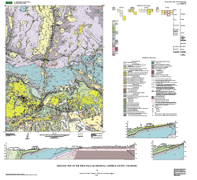
riflef24k.pdf: A file for viewing and printing a graphics version of the map and accessory elements using Adobe Acrobat viewing software (version 4.0). Accessory map elements displayed in this graphics file are: (1) geologic cross section A-A', (2) geologic cross section B-B', (3) geologic cross section C-C', (4) correlation of map units diagram, (5) list of map unit symbols and names, and (6) explanation of map symbols.
riflefexpl.pdf: A detailed text description of geologic map units and a brief discussion of deposits, structure, and geologic history of the map area.
rifleftext coverage: Contains text points that define the position, rotation, and size of text to appear on the face of the map. Also includes arcs that draw leaders from the text to the appropriate polygons. This coverage is for cartographic purposes and does not include data critical to the database information. The P1 item defines rotation of the text, the P2 item the size of text, and the TEXT item the actual text.
Gsmrelate INFO file: Contains the information that relates the riflefcode.lut and riflefunit.lut to the pat and aat INFO files of the coverages.
riflefunit.lut INFO file: Contains the first two columns of the table below that lists the number (P1 item) assigned to each category of polygon and the corresponding text symbol used in the map explanation and on the face of the map.
riflefcode.lut INFO file: Contains a text definition of the meaning of the number stored in the CODE item of every entity in all the coverages.
riflefcolor.lu INFO file: Assigns a color from shadeset 524 for each category of polygon according to the P1 item.
Gsmdraw.aml and gsmdraw.mnu files are included to constitute an ARC/INFO macro language program that will extract information from the riflef coverages to produce a graphics (.gra) file depicting the riflef geologic map. The graphics file can be viewed on screen or plotted with appropriate equipment.
The aml program calls shadeset 524.shd, font font003, and lineset alcwrg.lin, so these are also included in the archive file. Other files can be substituted, but special geologic characters may not plot properly with a different font.
Database root name: riflef
P1  | GEOLOGIC MAP UNIT LABELS
100 | af
124 | Qac
126 | Qfy
127 | Qlo/Qfo
131 | Qlo/Qp
134 | QTg
136 | Qc
138 | Qsw
141 | Qfp
142 | Qls
154 | Qd
155 | Qg
167 | Qlo/Qg
169 | Qcm
171 | shear zone
180 | Qlo
184 | Qtu
413 | Kicc
432 | Kmu
437 | Kmn
444 | Kml
458 | Kd
466 | Jm
469 | Jeg
472 | Je
486 | @c
498 | @Ps
550 | &ee
564 | Ml
566 | Dc
567 | Ddc
569 | Ddb
582 | P&ml
584 | Pms
612 | &b
684 | Water
685 | O\u
686 | &ev
687 | &evl
689 | Dp
Note: @ = Triassic; & = Pennsylvanian; \ = Cambrian
DEFINITION OF CODES IN THE DATABASE COVERAGES (CODES AND TEXT LISTED IN THE .AAT AND .PAT FILES)
CODE |   FEATURE
001  | contact; certain
003  | contact; inferred
008  | landslide; scarp; contact
009  | landslide on fault; contact certain
010  | fault; contact; certain
011  | fault; contact; concealed
014  | fault; contact; inferred
032  | fault; strike slip; concealed
034  | fault contact; strike slip; inferred
040  | thrust fault contact; certain
041  | thrust fault; concealed
044  | thrust fault contact; approximate location
070  | fold axis; anticline; certain
071  | fold axis; anticline; concealed
074  | fold axis; syncline; certain
075  | fold axis; syncline; concealed
078  | line of section
088  | intrusive dike; contact; certain
089  |  'intrusive dike; contact; concealed
093  | water boundary, certain
097  | scratch boundary
099  | map boundary
201  | bedding attitude symbol
203  | fault dip symbol
204  | anticline symbol
205  | syncline symbol
206  | adit symbol
207  | ball & bar symbol
209  | left lateral symbol
219  | over turned bed symbol
242  | Question mark symbol to indicate uncertainty in a reach of a linear feature
268  | diamond arrow symbol
300  | Plots the symbol number read from P2
362  | Flat bedding symbol
500  | Unit labels text & tag
501  | Hidden unit tags
502  | Ordinary text
503  | Ordinary text
700  | Splined text
Distribution_Information:
Distributor:
Contact_Information:
Contact_Organization_Primary:
Contact_Organization: U.S. Geological Survey
Contact_Address:
Address_Type: mailing address
Address: Central Publications Group
Address: MS 902, Box 25046, DFC
City: Denver
State_or_Province: CO
Postal_Code: 80225-0046
Contact_Voice_Telephone: 1-888-ASK-USGS
Distribution_Liability:
Although this digital spatial data has been subjected to rigorous review and is substantially complete, it is released on the condition that neither the USGS nor the United States Government may be held liable for any damages resulting from its authorized or unauthorized use.
Standard_Order_Process:
Digital_Form:
Digital_Transfer_Information:
Format_Name: ARCE
Format_Version_Number: 7.1.2
Format_Information_Content: Geologic units and structural features
File_Decompression_Technique: gzip -d and tar or unzip
Digital_Transfer_Option:
Online_Option:
Computer_Contact_Information:
Network_Address:
Digital_Form:
Digital_Transfer_Information:
Format_Name: Shapefile
Format_Version_Number: 1.0
Format_Information_Content: Geologic units and structural features
File_Decompression_Technique: gzip -d and tar or unzip
Digital_Transfer_Option:
Online_Option:
Computer_Contact_Information:
Network_Address:
Fees: none
Metadata_Reference_Information:
Metadata_Date: 20160613
Metadata_Contact:
Contact_Information:
Contact_Person_Primary:
Contact_Person: Peter N Schweitzer
Contact_Organization: USGS Midwest Area
Contact_Position:
Collection manager, USGS Geoscience Data Clearinghouse, http://geo-nsdi.er.usgs.gov/
Contact_Address:
Address_Type: mailing address
Address:
Mail Stop 954
12201 Sunrise Valley Dr
City: Reston
State_or_Province: VA
Postal_Code: 20192-0002
Country: USA
Contact_Voice_Telephone: 703-648-6533
Contact_Facsimile_Telephone: 703-648-6252
Contact_Electronic_Mail_Address: pschweitzer@usgs.gov
Metadata_Standard_Name: Content Standard for Digital Geospatial Metadata
Metadata_Standard_Version: FGDC-STD-001-1998


This page is <https://geo-nsdi.er.usgs.gov/metadata/map-mf/2341/metadata.html>
Generated by mp version 2.9.48 on Tue Jul 03 20:05:03 2018